Ghalegaun
Appearance
Ghalegaunnn
घलेगाउँ | |
|---|---|
 Ghalegaun | |
| Coordinates: 28°27′50″N 84°30′20″E / 28.46389°N 84.50556°E | |
| Country | Nepal |
| Number 4 | Federal State |
| Zone | Gandaki Zone |
| District | Lamjung District |
| Highest elevation | 2,100 m (6,900 ft) |
| Population | |
| • Ethnics group | Gurung |
| • Religions | Hinduism Buddhism |
| Time zone | UTC+5:45 (NST) |
Ghalegaun (Template:Lang-ne) is popular scenic tourist destination with an elevation of 2,100 metres above sea level in Lamjung District. Ghalegaun is also known as Asia’s model tourism village. It lies in kwholasothar rural Municipality of Nepal.[1] The village is situated at approximately 108 km northwest of Kathmandu and 12.5 km northeast of Pokhara, Nepal.[2][3][4][5][6] The beautiful tourist village is surrounded by Annapurna Circuit. The SAARC Village Tourism Museum is one of the attraction of Ghalegaun which is inaugurated by Bidhya Devi Bhandari in 2017.[7]
The site visitors are increasing day by day and the village is developed as a model touristic destinations in SAARC countries.[8][9]
Attractions
- Cultural
- Environmental education
- Family travel
- Nature cruises
- Photography
- Singles tour
- Senior tours
- Religious
- Homestay with cultural program
Mountains seen from Ghalegaun
- Mount Machhapuchare (6693m)
- Mount Annapurna (8091m)
- Mount Annapurna II (7939m)
- Mount Annapurna IV (7525m)
- Mount Lamjung (6932m)
- Mount Bouddha (6974m)
- Himalchuli (6747m)
Gallery
-
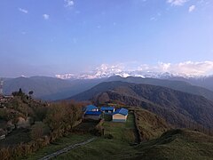
Mountain view in background from Ghalegaun.
-
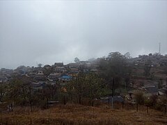
Ghalegaun seen in mist.
-
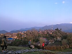
Ghalegaun.
-
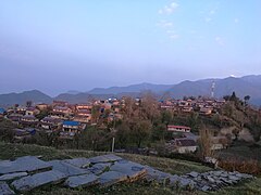
Ghalegaun, early in the morning.
References
- ^ Ghalegaun Homestay
- ^ http://www.nepalfctrekking.com/ghale-gaun-village-tours.php
- ^ http://www.ghalegaun.com.np/
- ^ 5-Day Ghale Gaun Home-Stay Tour. GetYourGuide.
- ^ http://www.tourtrekinnepal.com/tour_packages.php#1
- ^ http://www.tourtrekinnepal.com/about_ghalegaun.php
- ^ "SAARC Village Tourism Museum". THT. Retrieved 14 June 2017.
- ^ "3,000 tourists visit Ghalegaun in last 7 months". THT. Retrieved 12 February 2016.
- ^ "A breath of fits a good place".
[[


