Romny
50°45′N 33°28′E / 50.750°N 33.467°E
Romny
Ромни, Ромны | |
|---|---|
 Former bank building in Romny | |
| Coordinates: 50°45′N 33°28′E / 50.750°N 33.467°E | |
| Country | Ukraine |
| Oblast | Sumy |
| Municipality | Romny city municipality |
| City rights | 1781 |
| Area | |
• Total | 65 km2 (25 sq mi) |
| Elevation | 171 m (561 ft) |
| Population (2015) | |
• Total | 40 681 |
| Website | http://forum.romny.info/ |


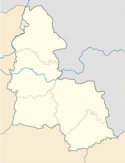
Romny (Template:Lang-uk) is a city in northern Ukrainian Sumy Oblast. It is located on the Romen River. Romny serves as the administrative center of Romny Raion. It is administratively incorporated as a city of oblast significance and does not belong to the raion. The villages of Lutschky (438 inhabitants), Kolisnykove (43 inhabitants) and Hrabyne belong to the Romny Municipality. Population: 40,681 (2015 est.)[1]
History
The city was founded in 902 AD. On September 16, 2002 the city celebrated its 1,100th anniversary. Romny was first mentioned in documents in 1096 (as Romen, Cyrillic: Ромен; the name, originally that of the river, is of Baltic origin, cf. Lithuanian romus 'quiet'[2]). By 1638, the city had a population of 6,000 inhabitants, which made it by far the largest settlement in the area. In 1781, the city was granted a charter by the Tsarina Catherine II.
In Romny the first statue of Taras Shevchenko was erected on 27 October 1918 when the city was located in the Ukrainian state, but it was preserved as part of the Soviet Union Ukrainization-policy's.[3] The concrete statue in Romny began to decay in the 1950s, but was remade in bronze and re-unveiled in 1982.[3] The original version of the monument is located on Kyiv's Andriyivskyy Descent.[3]
During World War II, Romny was occupied by the German Army from September 10, 1941 to September 16, 1943.
In the period between 1979 and 1989, Romny's population rose from 53,016 to 57,502 inhabitants.
Sights
The cathedral of the Holy Spirit, founded in 1735 in place of a wooden church, is a four-pillared cathedral designed in the Ukrainian Baroque style and is surmounted by three pear-shaped domes, each placed on a tall cylinder. Although the cathedral dates back to the 1740s, the building of the nearby belfry and winter church was not undertaken until 1780.
Another noteworthy building is the church of the Ascension, which also has three domes, but was constructed later, in 1795–1801, and adjoins a Baroque belfry built in 1753–63.
Local government
Beside the city itself, the city municipality also serves as government for a village Kolisnykove and a settlement Luchky.
The city also has administration of the surrounding Romny Raion.
Gallery
-
Downtown Romny
-
Ascension Church in Romny
-
Conference building
-
Former seminary
-
Roman Catholic church in Romny
-
Former trading house
-
Historical school building
-
Market Square in Romny
-
Taras Shevchenko monument
-
Steam mill in Romny
-
District hospital building
-
High school building
-
Church of All Saints in Romny
-
Historic hospital building
-
Bus station in Romny
Famous people from Romny
- Yevhen Adamtsevych
- Haim Arlosoroff, a notable Zionist leader
- Maksym Biletskyi
- Larisa Netšeporuk
- Pinhas Rutenberg, prominent engineer, businessman, a Russian socialist and a Zionist leader
- Isaac Schwartz, Soviet composer
- Grigory Sokolnikov, Soviet politician
- Joachim Stutschewsky, Ukraine-born Austrian and Israeli cellist, composer, and musicologist
- Abram Ioffe, a prominent Soviet/Russian physicist
- Several of the founding members of Degania, the first kibbutz settlement in Palestine (1910)
References
- ^ "Чисельність наявного населення України (Actual population of Ukraine)" (PDF) (in Ukrainian). State Statistics Service of Ukraine. Retrieved 1 July 2016.
- ^ E.M. Pospelov, Geograficheskie nazvaniya mira (Moscow, 1998), p. 355.
- ^ a b c (in Ukrainian) 100 years ago the first monument to Taras Shevchenko was built for the Hetmanate, Radio Svoboda (14 October 2018)


