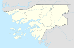
Alabato
Appearance
Alabato | |
|---|---|
Village | |
| Coordinates: 12°29′21″N 15°21′20″W / 12.48917°N 15.35556°W | |
| Country | |
| Region | Oio Region |
| Sector | Farim |
| Time zone | UTC+0 (GMT) |
Alabato is a village in the Oio Region of northern Guinea-Bissau.
Location
It is located east of Cufeu.[1][2]
References
- ^ Google Maps (Map). Google.
- ^ Bing Maps (Map). Microsoft and Harris Corporation Earthstar Geographics LLC.

