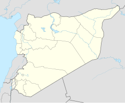
Zayzafun
al-Zayzafun
الزيزفون | |
|---|---|
Village | |
| Coordinates: 36°38′59″N 37°10′51″E / 36.6497°N 37.1808°E | |
| Country | |
| Governorate | Aleppo |
| District | Azaz |
| Subdistrict | Sawran |
| Elevation | 510 m (1,670 ft) |
| Population (2004)[1] | 820 |
| Time zone | UTC+2 (EET) |
| • Summer (DST) | UTC+3 (EEST) |
| Geocode | C1658 |
Zayzafun (Template:Lang-ar), also known as Ikadah (Template:Lang-ar) which may be alternatively spelled Aykadah or Ekdeh, is a village in the northern Aleppo countryside, Aleppo Governorate, northwestern Syria. Located on the Queiq Plain, between Azaz and Al-Rai, the village is some 45 kilometres (28 mi) north of the city of Aleppo, and just 1 km (0.62 mi) south of the border with the Turkish Province of Kilis, and it has many families of Turkish ethnicity and background.
Administratively the village belongs to Nahiya Sawran in Azaz District. Nearby localities include Kafr Ghan 2 km (1.2 mi) to the south and Hawar Kilis 3 km (1.9 mi) to the east. In the 2004 census, Zayzafun had a population of 820.[1]
Syrian civil war
In the Syrian civil war, the Ikadah IDP Camp, located 1 km (0.62 mi) north of the village at the border to Turkey, offered shelter to internally displaced persons (IDPs), mostly from the subdistricts of Azaz, Nubl, Tell Rifaat and Mare'.[2] In April 2016, the Ikadah camp was filled with 7,763 IDPs, when an imminent ISIL counter-offensive prompted a complete evacuation of the Ikadah camp and neighboring camps near Shamarin and Harjala.[3] On April 14, rebels retreated from Zayzafun and the neighboring villages down to Kafr Ghan and Baraghida, leaving the remaining rebel forces around Dudyan surrounded by ISIL.[4][5]
References
- ^ a b "2004 Census Data for Nahiya Sawran, Aleppo Governorate" (in Arabic). Syrian Central Bureau of Statistics. Also available in English: UN OCHA. "2004 Census Data". Humanitarian Data Exchange.
- ^ REACH Situation Overview: Displacement from Aleppo Governorate, Syria (PDF) (Report). REACH Initiative. 18 February 2016. Retrieved 7 September 2016.
- ^ Situation Overview: Displacement in Northern Aleppo Governorate towards A’zaz (PDF) (Report). REACH Initiative. 21 April 2016. Retrieved 7 September 2016.
- ^ Chris Tomson (14 April 2016). "Rebels flee across Turkish border as ISIS snatches more villages – Map update". Al-Masdar News. Retrieved 17 April 2016.
- ^ Flash Update Developments in Northwestern Syria (PDF) (Report). UN OCHA. 14 April 2016. Retrieved 8 September 2016.


