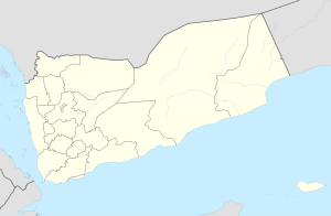
Al-Munaqqab
Appearance
Al-Munaqqab
المنقب | |
|---|---|
Village | |
| Coordinates: 15°28′38″N 44°01′02″E / 15.47712°N 44.01735°E[1] | |
| Country | |
| Governorate | Sanaa |
| District | Hamdan |
| Elevation | 8,638 ft (2,633 m) |
| Time zone | UTC+3 (Yemen Standard Time) |
Al-Munaqqab (Arabic: المنقب al-Munaqqab) is a village in Hamdan District of Sanaa Governorate, Yemen.[1][2] It lies to the north of the road between Sanaa and Shibam Kawkaban, and is built on a small hill of porous volcanic rock, with some houses being built directly into the hillside.[2] It was the site of a minor fortress during the late medieval and early modern period, and is first mentioned in historical records in 683 AH (1284 CE).[2]
References
- ^ a b c "Geonames.org. Al Munaqqab". Retrieved 7 February 2021.
- ^ a b c Wilson, Robert T.O. (1989). Gazetteer of Historical North-West Yemen. Germany: Georg Olms AG. pp. 320–21. Retrieved 7 February 2021.

