Araneta Center–Cubao station (MRT)
This article needs additional citations for verification. (February 2021) |
Araneta Center–Cubao | |||||||||||
|---|---|---|---|---|---|---|---|---|---|---|---|
 | |||||||||||
| General information | |||||||||||
| Other names | Araneta–Cubao Cubao | ||||||||||
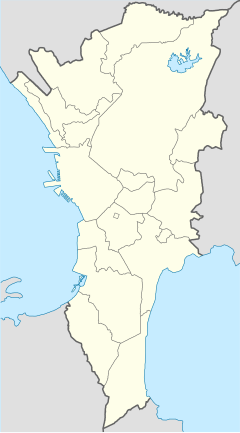
| Location | EDSA, San Martin De Porres & Socorro Quezon City, Metro Manila Philippines | ||||||||||
| Owned by | Metro Rail Transit Corporation | ||||||||||
| Operated by | Department of Transportation | ||||||||||
| Line(s) | MRT Line 3 | ||||||||||
| Platforms | 2 (2 side) | ||||||||||
| Tracks | 2 | ||||||||||
| Connections | Future: | ||||||||||
| Construction | |||||||||||
| Structure type | Elevated | ||||||||||
| Parking | Yes (Farmers Plaza, South Parking Garage)[1] | ||||||||||
| Accessible | Concourse: All entrances Platforms: All platforms | ||||||||||
| Other information | |||||||||||
| Station code | AC | ||||||||||
| History | |||||||||||
| Opened | December 15, 1999 | ||||||||||
| Services | |||||||||||
| |||||||||||
| Out-of-system interchange | |||||||||||
| |||||||||||
| |||||||||||
Araneta Center–Cubao station, also known as Araneta–Cubao or simply as Cubao, rarely known as Araneta, is an elevated Metro Rail Transit (MRT) station located on the MRT Line 3 (MRT-3) system in Cubao, Quezon City. It is named after the old name of the Araneta City, a mixed-used development in the city.
The station is the fourth station for trains headed to Taft Avenue and the tenth station for trains headed to North Avenue. It is one of five stations on the line where passengers can catch a train going in the opposite direction without paying a new fare due to the station's layout. The other four stations are Shaw Boulevard, Boni, Buendia, Ayala, and Taft Avenue. It is also the only station on the line with its concourse level located below the platform.
History
Araneta Center–Cubao station was opened on December 15, 1999, as part of MRT's initial section from North Avenue to Buendia.[2]
Nearby establishments
The most recognizable landmark that the station is located at is Araneta City, a mixed-use complex which hosts shopping malls such as Gateway Mall, Ali Mall, and Farmers Plaza. It also hosts an indoor arena, the Smart Araneta Coliseum. Hotel such as Nice Hotel and Vista Hotel are located west of the station.
Transportation links
Due to its location at Araneta City, the station is located in a major transportation hub. Prior to the establishment of the EDSA Carousel, provincial buses stopped at the Araneta Center Bus Terminal within the complex. Currently, the EDSA Carousel does not stop at Cubao and as such, is served by other bus routes. Jeepneys for various destinations all over Metro Manila and Rizal province, taxis and tricycles are available upon request. Traffic regulations, however, prohibit tricycles on EDSA and Aurora Boulevard.
The station is also the transfer point for commuters riding the Manila Light Rail Transit System Line 2, or Line 2. Through a walkway, it is directly connected to New Farmers Plaza, which in turn leads to the namesake station on the Line 2, the station's entrance just outside the Gateway Mall, and the Smart Araneta Coliseum.
Gallery
-
View of nearby Cubao buildings
-
Platform area
-
View from the Vivaldi Residences Cubao
-
A four-car MRTC 3000 class train at Araneta Center-Cubao station in April 2022
See also
References
- ^ "Parking Guide". Araneta City. Retrieved June 3, 2020.
- ^ "Miracle rail project to rid Edsa of jams". New Straits Times. The New Straits Times Press (M) Bhd. December 15, 1999. Retrieved January 21, 2014 – via Google News Archive.
External links
- The Metrostar Express
- Araneta Center-Cubao Station (Line 3) satellite image on Google Maps


