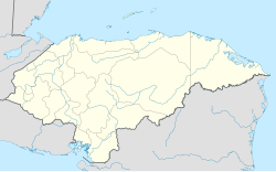
Azacualpa, Honduras
Appearance
Azacualpa
Azacualpence | |
|---|---|
Municipality | |
 | |
| Coordinates: 14°43′0″N 88°6′0″W / 14.71667°N 88.10000°W | |
| Country | |
| Department | Santa Bárbara |
| Villages | 10 |
| Government | |
| • Alcalde | Medardo Rosa |
| Area | |
• Municipality | 199 km2 (77 sq mi) |
| Population (2023 projection)[1] | |
• Municipality | 25,920 |
| • Density | 130/km2 (340/sq mi) |
| • Urban | 19,030 |
| • Summer (DST) | NOR-OCCIDENTE |
| Area code | 011504 |
| Climate | Aw |
Azacualpa (Spanish pronunciation: [asaˈkwalpa]) is a town, with a population of 11,800 (2023 calculation),[2] and a municipality in the Honduran department of Santa Bárbara, known for its coffee production.[3]
Demographics
At the time of the 2013 Honduras census, Azacualpa municipality had a population of 20,210. Of these, 93.62% were Mestizo, 5.15% White, 0.59% Indigenous, 0.50% Black or Afro-Honduran and 0.14% others.[4]
References
- ^ Citypopulation.de Population of departments and municipalities in Honduras
- ^ Citypopulation.de Population of cities in Honduras
- ^ Honduran villagers take legal action to stop mining firm digging up graves for gold Published by The Guardian, 28 May, 2018, retrieved 28 May, 2018
- ^ Instituto Nacional de Estadística (INE), bases de datos en línea


