Blönduós Airport
Appearance
Blönduós Airport Hjaltabakki Airport | |||||||||||
|---|---|---|---|---|---|---|---|---|---|---|---|
 | |||||||||||
| Summary | |||||||||||
| Airport type | Public | ||||||||||
| Owner/Operator | Isavia | ||||||||||
| Elevation AMSL | 131 ft / 40 m | ||||||||||
| Coordinates | 65°38′45″N 20°17′15″W / 65.64583°N 20.28750°W | ||||||||||
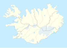
| Map | |||||||||||
 | |||||||||||
| Runways | |||||||||||
| |||||||||||
Blönduós Airport (IATA: BLO, ICAO: BIBL) is an airport serving Blönduós, Iceland.
There are no scheduled flights. It is occasionally used for air ambulances.[4] The nearest airport with scheduled flights is Akureyri Airport, 148 km from Blönduós.
The Blonduos non-directional beacon (Ident: BL) is 2.5 nautical miles north of the runway 21 threshold.[5][6]
See also
References
- ^ "Archived copy" (PDF). Archived from the original (PDF) on 2013-08-29. Retrieved 2013-12-03.
{{cite web}}: CS1 maint: archived copy as title (link) - ^ Google Maps - Blönduós
- ^ Airport information for BLO at Great Circle Mapper.
- ^ Erfiðar aðstæður á Blönduósi fyrir sjúkraflug
- ^ Blonduos NDB
- ^ SkyVector Aeronautical Charts
- Google Earth
External links

