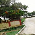
Gandasi
Appearance
Gandasi | |
|---|---|
Village | |
| Gandasi | |
| Coordinates: 13°09′34″N 76°18′18″E / 13.159393°N 76.305024°E | |
| Country | |
| State | Karnataka |
| District | Hassan |
| Taluk | Arsikere |
| Government | |
| • Body | Grama Panchayath |
| Area | |
• Total | 6.58 km2 (2.54 sq mi) |
| Elevation | 930 m (3,050 ft) |
| Population (2011) | |
• Total | 3,729 [1] |
| Languages | |
| • Official | Kannada |
| Time zone | UTC+5:30 (IST) |
| PIN | 573119 |
| Vehicle registration | KA-13 |
Gandasi is a "hobli" in Hassan district of India. As per census survey of India 2011, the location code number of Gandasi is 615799.
Location
Gandasi village is located in Arsikere Taluk of Hassan district, Karnataka state, India. The village is located on State Highway 7 between Mysuru and Arsikere.[2]
Postal code
There is a post office in Gandasi and the postal code is 573119.[3]
Schools In Gandasi
- HPS S.s.p.school Gandasi
- HPS New central school Gandasi
- PH.p.school Gandasi
- Gmhp school Gandasi
- Guhp school Gandasi
Colleges near to Gandasi
- Government PU College
- Vidyaranga pre university college
- Government First Grade college
==Govt Health centres near Gandasi==
1) J.C.H-B , , B H Road , Taluk Hospital Building. 2) Juttnally , JUNIOR HEALTH ASSISTANT FEMALE , , 3) D.Hosahally , JUNIOR HEALTH ASSISTANT FEMALE,,.
Image gallery
-
Bus Station
-
School
See also
References
- ^ "Census Data Handbook 2011" (PDF). Retrieved 1 September 2023.
- ^ "13°10'03.1"N 76°17'36.9"E". Google.co.in. Retrieved 23 February 2019.
- ^ "GANDASI Pin Code, Search GANDASI HASSAN PinCode". Citypincode.in. Retrieved 23 February 2019.


