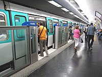
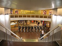
Invalides station
You can help expand this article with text translated from the corresponding article in French. (November 2022) Click [show] for important translation instructions.
|
Invalides | ||||||||||||||||||||||||||
|---|---|---|---|---|---|---|---|---|---|---|---|---|---|---|---|---|---|---|---|---|---|---|---|---|---|---|
 Invalides station Métro Line 8 platforms | ||||||||||||||||||||||||||
| General information | ||||||||||||||||||||||||||
| Location | Paris France | |||||||||||||||||||||||||
| Coordinates | 48°51′47″N 2°18′48″E / 48.86299°N 2.31333°E | |||||||||||||||||||||||||
| Operated by |
| |||||||||||||||||||||||||
| Platforms |
| |||||||||||||||||||||||||
| Tracks |
| |||||||||||||||||||||||||
| Connections | ||||||||||||||||||||||||||
| Construction | ||||||||||||||||||||||||||
| Structure type | Underground | |||||||||||||||||||||||||
| Accessible | No[1][2] | |||||||||||||||||||||||||
| Other information | ||||||||||||||||||||||||||
| Station code |
| |||||||||||||||||||||||||
| Fare zone | 1 | |||||||||||||||||||||||||
| History | ||||||||||||||||||||||||||
| Opened | 13 July 1913 | |||||||||||||||||||||||||
| Services | ||||||||||||||||||||||||||
| ||||||||||||||||||||||||||
Invalides station (French pronunciation: [ɛ̃valid] ⓘ) is a station on Line 8 and Line 13 of the Paris Métro, as well as a station on RER C. Located in the 7th arrondissement, it is situated near and named after Les Invalides, although La Tour-Maubourg (Line 8) and Varenne (Line 13) are closer to the building.
History
The Métro station was opened on 13 July 1913 as part of the original section of Line 8 between Beaugrenelle (now Charles Michels on Line 10) and Opéra. The Line 13 platforms were opened on 20 December 1923 as part of the original section of Line 10 between Invalides and Croix-Rouge (a station east of Sèvres – Babylone, which was closed during World War II). On 27 July 1937 the section of Line 10 between Invalides and Duroc was transferred to become the first section of the old Line 14, which was connected under the Seine and incorporated into Line 13 on 9 November 1976.
The Palais Bourbon, seat of the National Assembly (the lower house of the French Parliament), is nearby, also served by Assemblée Nationale on Line 12.
Passenger services
Access
The station has a single access to the eastern part of the Esplanade des Invalides near the intersection of Rue de Constantine and Rue de l'Université.
Station layout
Métro
| G | Street Level | Exit/Entrance |
| B1 | Mezzanine | Fare control, station agent |
| B2 | Side platform, doors will open on the right | |
| Northbound | ← | |
| Southbound | | |
| Island platform, doors will open on the left, right | ||
| Southbound | | |
| B3 | ||
| Side platform, doors will open on the right | ||
| Westbound | ← | |
| Eastbound | | |
| Side platform, doors will open on the right | ||
RER
| G | Street Level | Exit/Entrance |
| B1 | Mezzanine | Tickets |
| B2 | Track 3 | |
| Island platform | ||
| Track 1 | | |
| Track 2 | ← | |
| Island platform | ||
| Track 4 | ← | |
Gallery
-
Street-level entrance at Invalides
Métro
-
MF 77 rolling stock on Line 8 at Invalides
-
Line 13 platforms at Invalides with automatic platform gates
-
Line 13 platforms prior to installation of automatic platform gates
RER
RER Station
The RER station was opened on 31 May 1902 by the Chemins de fer de l'Ouest. It was originally a terminus but was extended to Gare d'Orsay & the line converted to RER C in 1979.

Nearby
See also
References
- ^ "Plan pour les voyageurs en fauteuil roulant" [Map for travelers in wheelchairs] (PDF). Île-de-France Mobilités (in French and British English). 2023. Retrieved 27 December 2023.
- ^ "Plan pour les voyageurs en fauteuil roulant" [Map for travelers in wheelchairs] (PDF). Île-de-France Mobilités (in French and British English). May 2022. Retrieved 27 December 2023.
External links
![]() Media related to Invalides (Paris Metro) at Wikimedia Commons
Media related to Invalides (Paris Metro) at Wikimedia Commons
![]() Media related to Gare des Invalides at Wikimedia Commons
Media related to Gare des Invalides at Wikimedia Commons
- Invalides station at Transilien, the official website of SNCF (in French)


