Khalkhal County
Khalkhal County
Persian: شهرستان خلخال | |
|---|---|
 | |
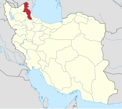
 Location of Khalkhal County in Ardabil province (bottom, pink) | |
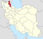
 Location of Ardabil province in Iran | |
| Coordinates: 37°30′N 48°32′E / 37.500°N 48.533°E[1] | |
| Country | Iran |
| Province | Ardabil |
| Capital | Khalkhal |
| Districts | Central, Khvoresh Rostam, Shahrud |
| Elevation | 1,843 m (6,047 ft) |
| Population (2016)[2] | |
• Total | 86,731 |
| Time zone | UTC+3:30 (IRST) |
| Khalkhal County at GEOnet Names Server | |
Khalkhal County (Persian: شهرستان خلخال)[a] is in Ardabil province, Iran. Its capital is the city of Khalkhal.[3]
Demographics
Language
The majority of Khalkhal County residents are Azerbaijanis, but there are many Tats and Kurds living in the southern areas of the county, especially in Shahrud District and Khvoresh Rostam District.[citation needed]
Population
At the time of the 2006 National Census, the county's population was 92,315 in 22,969 households.[4] The following census in 2011 counted 92,332 people in 25,763 households.[5] The 2016 census measured the population of the county as 86,731 in 26,779 households.[2]
Administrative divisions
Khalkhal County's population history and administrative structure over three consecutive censuses are shown in the following table.
| Administrative Divisions | 2006[4] | 2011[5] | 2016[2] |
|---|---|---|---|
| Central District | 64,037 | 66,901 | 61,122 |
| Khanandabil-e Gharbi RD | 5,572 | 5,550 | 4,237 |
| Khanandabil-e Sharqi RD | 15,102 | 15,946 | 14,374 |
| Sanjabad-e Sharqi RD | 4,842 | 4,240 | 3,207 |
| Khalkhal (city) | 38,521 | 41,165 | 39,304 |
| Khvoresh Rostam District | 14,577 | 12,781 | 13,839 |
| Khvoresh Rostam-e Jonubi RD | 5,775 | 4,745 | 4,875 |
| Khvoresh Rostam-e Shomali RD | 4,284 | 3,458 | 3,239 |
| Hashjin (city) | 4,518 | 4,578 | 5,725 |
| Shahrud District | 13,701 | 12,650 | 11,770 |
| Palanga RD | 5,067 | 5,619 | 5,000 |
| Shahrud RD | 1,864 | 1,423 | 1,213 |
| Shal RD | 4,390 | 3,503 | 3,210 |
| Kolowr (city) | 2,380 | 2,105 | 2,347 |
| Total | 92,315 | 92,332 | 86,731 |
| RD = Rural District | |||
Tourist attractions
- Lerd tourist village in Shahroud district
- Sibieh Khani Waterfall in Lerd, Shahroud district
- Andabil
- Gilavan
- Neor Lake

See also
![]() Media related to Khalkhal County at Wikimedia Commons
Media related to Khalkhal County at Wikimedia Commons
Notes
- ^ Azerbaijani: شهرستان خلخال بؤلگهسی
References
- ^ OpenStreetMap contributors (20 August 2024). "Khalkhal County" (Map). openstreetmap.org (OpenStreetMap) (in Persian). Retrieved 20 August 2024.
- ^ a b c Census of the Islamic Republic of Iran, 1395 (2016): Ardabil Province. amar.org.ir (Report) (in Persian). The Statistical Center of Iran. Archived from the original (Excel) on 22 March 2019. Retrieved 19 December 2022.
- ^ Habibi, Hassan (c. 2021) [Approved 21 June 1369]. Approval of the organization and chain of citizenship of the elements and units of the national divisions of East Azerbaijan province, centered in the city of Tabriz. qavanin.ir (Report) (in Persian). Ministry of the Interior, Defense Political Commission of the Government Council. Resolution 93808/T907. Archived from the original on 23 October 2021. Retrieved 21 February 2024 – via Laws and Regulations Portal of the Islamic Republic of Iran.
- ^ a b Census of the Islamic Republic of Iran, 1385 (2006): Ardabil Province. amar.org.ir (Report) (in Persian). The Statistical Center of Iran. Archived from the original (Excel) on 20 September 2011. Retrieved 25 September 2022.
- ^ a b Census of the Islamic Republic of Iran, 1390 (2011): Ardabil Province. irandataportal.syr.edu (Report) (in Persian). The Statistical Center of Iran. Archived from the original (Excel) on 15 January 2023. Retrieved 19 December 2022 – via Iran Data Portal, Syracuse University.

