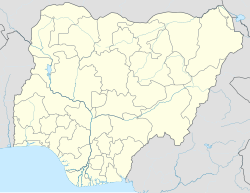
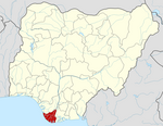
Kolokuma/Opokuma
Appearance
Kolokuma/Opokuma | |
|---|---|
LGA and town | |
| Coordinates: 5°08′N 6°18′E / 5.133°N 6.300°E | |
| Country | |
| State | Bayelsa State |
| Headquarters | Kaiama |
| Area | |
• Total | 361 km2 (139 sq mi) |
| Population (2006 census) | |
• Total | 77,292 |
| Time zone | UTC+1 (WAT) |
| 3-digit postal code prefix | 560 |
| ISO 3166 code | NG.BY.KO |
 | |
Kolokuma/Opokuma is a Local Government Area of Bayelsa State, Nigeria. Its headquarters are in the town of Kaiama. Much of the area of the LGA is occupied by the Bayelsa National Forest.
It has an area of 361 km2 and a population of 77,292 at the 2006 census.
The postal code of the area is 560.[1]
Climate/Geography
The entire area of Kolokuma Opokuma LGA is 361 square kilometers, with an average temperature of 26 degrees Celsius. The Bayelsa National Forest is located in this densely forested region. The Efi lake is one of the many rivers and lakes that flow through the region.[2][3]
References
- ^ "Post Offices- with map of LGA". NIPOST. Archived from the original on 2012-11-26. Retrieved 2009-10-20.
- ^ "Kolokuma/Opokuma Local Government Area". www.manpower.com.ng. Retrieved 2024-08-09.
- ^ "Kolokuma, Nigeria 10-Day Weather Forecast | Weather Underground". www.wunderground.com. Retrieved 2024-08-09.


