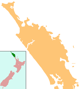
Lake Waiporohita
Appearance
| Lake Waiporohita | |
|---|---|
| Location | Northland Region, North Island |
| Coordinates | 34°54′S 173°21′E / 34.900°S 173.350°E |
| Catchment area | 52.7 hectares (130 acres) |
| Basin countries | New Zealand |
| Surface area | 6.8 hectares (17 acres) |
| Max. depth | 3.5 metres (11 ft) |
Lake Waiporohita is a dune lake in the Northland Region of New Zealand. It is located near Tokerau Beach on the Karikari Peninsula.
The small lake has no inflows or outflows. The lake catchment is primarily fenced pasture, with some Manuka scrub and Pohutukawa.[1]
The lake is monitored by Northland Regional Council, and the environmental information can be viewed on the LAWA website.[2]
See also
References
- ^ "Northland Lakes Ecological Status 2010". Northland Regional Council. Retrieved 27 April 2020.
- ^ "Lake Waiporohita Water Quality". Land, Air, Water Aotearoa (LAWA). Retrieved 27 April 2020.
"Place name detail: Lake Waiporohita". New Zealand Gazetteer. New Zealand Geographic Board. Retrieved 23 July 2009.

