Ospeldijk
Appearance
Ospeldijk | |
|---|---|
Village | |
| Coordinates: 51°19′13″N 5°48′49″E / 51.32028°N 5.81361°E | |
| Country | Netherlands |
| Province | Limburg |
| Municipality | Nederweert |
| Area | |
• Total | 0.90 km2 (0.35 sq mi) |
| Elevation | 32 m (105 ft) |
| Population (450)[1] | |
• Total | 3,730 |
| • Density | 4,100/km2 (11,000/sq mi) |
| Time zone | UTC+1 (CET) |
| • Summer (DST) | UTC+2 (CEST) |
| Postal code | 6035[1] |
| Dialing code | 0495 |
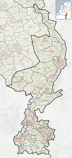
Ospeldijk is a village in the Dutch province of Limburg. It is a part of the municipality of Nederweert, and lies about 11 km northeast of Weert.
The village was first mentioned in 1978 as Meijelse Dijk, and means "dike near Ospel".[3]
The Holy Spirit Church was a modern aisleless church built between 1957 and 1958.[4] The church was demolished in 2008 and replaced by houses.[5]
Ospeldijk is an access point to De Groote Peel National Park.[5]
References
- ^ a b c "Kerncijfers wijken en buurten 2021". Central Bureau of Statistics. Retrieved 25 April 2022.
- ^ "Postcodetool for 6035AA". Actueel Hoogtebestand Nederland (in Dutch). Het Waterschapshuis. Retrieved 25 April 2022.
- ^ "Ospeldijk - (geografische naam)". Etymologiebank (in Dutch). Retrieved 25 April 2022.
- ^ Sabine Broekhoven, & Ronald Stenvert (2003). Ospel (in Dutch). Zwolle: Waanders. ISBN 90 400 9623 6. Retrieved 25 April 2022.
- ^ a b "Ospeldijk". Plaatsengids (in Dutch). Retrieved 25 April 2022.


