Piriaka

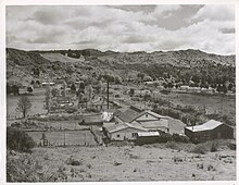
Piriaka is a small rural settlement beside the Whanganui River, about 10 kilometres (6.2 mi) southeast of Taumarunui on State Highway 4 (SH4), in New Zealand's King Country. Its name is Māori, from piri (to cling close) and aka (bush climbers of various kinds, such as rata).[1]
The Piriaka Power Station is about 1 kilometre (0.62 mi) north of the settlement.
The Piriaka springs can be found just to the south of Piriaka (beside SH4 just at it starts to climb up to a higher altitude) at 38°55′33″S 175°20′27″E / 38.92583°S 175.34083°E. These springs are well known in the local area, and also provide the main water supply for the settlement.[2][3]
About 1 kilometre (0.62 mi) further south along SH4, at 38°55′56″S 175°20′37″E / 38.93222°S 175.34361°E, there is a lookout providing an excellent view of the Whanganui River. This spot is known as the Piriaka lookout.
References
External links
See also
38°55′17″S 175°20′10″E / 38.92139°S 175.33611°E
