Poll Island
Appearance
Native name: Guijar | |
|---|---|
 Satellite image | |
| Geography | |
| Location | Oceania |
| Coordinates | 10°15′17″S 142°49′49″E / 10.25472°S 142.83028°E |
| Archipelago | The Three Sisters (Queensland) |
| Adjacent to | Pacific Ocean |
| Area | 0.114 km2 (0.044 sq mi) |
| Administration | |
| Demographics | |
| Population | Uninhabited |
| Additional information | |
| Time zone | |
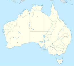
Poll Islet, (also known as Guijar or Poll Island), is an Australian island in the center of the Torres Strait Islands.[1] It lies in the southern part of The Three Sisters island group and is located 5.2 kilometres (3.2 mi) south off Sue Island, the middle and only inhabited island in The Three Sisters.[2] It is within the Guijar Islet locality in the Torres Strait Island Region local government area.[3]
Poll Islet has a surface area of about 11 hectares, and is enclosed by a 5 km² oval-shaped coral reef known as the Poll Islet Reef.
See also
References
- ^ "Poll Islet – island in the Torres Strait Island Region (entry 27246)". Queensland Place Names. Queensland Government. Retrieved 4 November 2019.
- ^ "Traveling Luck for Poll Island, Queensland, Australia". Traveling Luck. Retrieved 4 October 2016.
- ^ "Guijar Islet – locality in Torres Strait Island Region (entry 46711)". Queensland Place Names. Queensland Government. Retrieved 11 June 2019.

