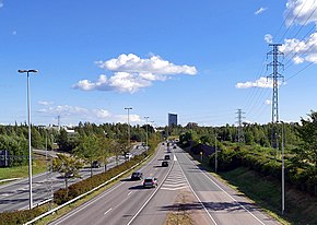
Ring II
You can help expand this article with text translated from the corresponding article in Finnish. (June 2023) Click [show] for important translation instructions.
|
| Regional Road 102 | |
|---|---|
Ring II
| |
 | |
 | |
| Route information | |
| Length | 6.8 km (4.2 mi) |
| Existed | 2000–present |
| Major junctions | |
| From | Turuntie |
| To | Länsiväylä |
| Location | |
| Country | Finland |
| Highway system | |
Ring II (pronounced "ring two", Finnish: Kehä II, Swedish: Ring II; also known as Kilonväylä[1]) in the city of Espoo is one of the major highways in Finland. The road runs north–south, connecting Turuntie in the north, to Länsiväylä in the south.[2] Despite its name suggesting a circle, it has not been built as a true beltway yet, unlike the parallel Ring I and Ring III highways.
History
The road was initially planned in the 1960s, but it was not until the end of 2000 that the first phase was completed.[2]
Future
Since the cross-city traffic in Espoo, Kauniainen and Vantaa is estimated to nearly double by the year 2025,[3] plans have been made to extend Ring II to connect up with Finnish national road 3 (Finnish: Hämeenlinnanväylä) in the northeast and add lanes where the road is currently only one lane wide in each direction.[4]
See also
References
- ^ Espoo puolustaa Kehä II:n jatketta – "Asukasmäärä kasvaa eivätkä liikkumisen tarve ja ruuhkaisuus vähene nykyisestä" (in Finnish)
- ^ a b "Tiehallinto – Kehä 2" (in Finnish). Retrieved 2008-05-04.
- ^ "Tiehallinto – Kehä 2 – The current situation" (in Finnish). Retrieved 2008-05-04.
- ^ "Tiehallinto – Kehä 2 – Future plans" (in Finnish). Retrieved 2008-05-04.
External links
![]() Media related to Kehä II at Wikimedia Commons
Media related to Kehä II at Wikimedia Commons
60°11′43″N 024°44′37″E / 60.19528°N 24.74361°E

