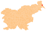
Strehovci
Appearance
Strehovci
Őrszentvid | |
|---|---|
| Coordinates: 46°39′37.47″N 16°19′10.34″E / 46.6604083°N 16.3195389°E | |
| Country | |
| Traditional region | Prekmurje |
| Statistical region | Mura |
| Municipality | Dobrovnik |
| Area | |
• Total | 6.96 km2 (2.69 sq mi) |
| Elevation | 175.9 m (577.1 ft) |
| Population (2020) | |
• Total | 223 |
| • Density | 32/km2 (83/sq mi) |
| [1] | |
Strehovci (pronounced [ˈstɾeːxɔu̯tsi]; Hungarian: Őrszentvid) is a village in the Municipality of Dobrovnik in the Prekmurje region of Slovenia.[2]

A chapel is built in the hills to the north of the main settlement and is dedicated to Saint Vitus. It belongs to the Parish of Bogojina.[3]
References
External links
 Media related to Strehovci at Wikimedia Commons
- Strehovci on Geopedia


