Ungut County
Appearance
(Redirected from Aguti District)
Ungut County
Persian: شهرستان انگوت | |
|---|---|
 Location of Ungut County in Ardabil province (top, green) | |
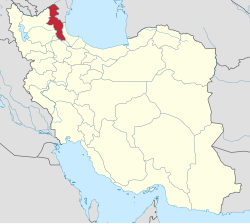
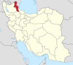
 Location of Ardabil province in Iran | |
| Coordinates: 39°01′16″N 47°43′03″E / 39.02111°N 47.71750°E[1] | |
| Country | Iran |
| Province | Ardabil |
| Capital | Angut |
| Districts | Central, Darrehrud |
| Area | |
• Total | 1,048 km2 (405 sq mi) |
| Time zone | UTC+3:30 (IRST) |
Ungut County (Persian: شهرستان انگوت)[a] is in Ardabil province, Iran. Its capital is the city of Angut,[2][b] whose population at the time of the 2016 National Census was 2,645 in 717 households.[3]
History
[edit]In 2019, Angut District was separated from Germi County in the establishment of Ungut County, which was divided into two districts of two rural districts each, with Angut as its capital and only city.[2]
Demographics
[edit]Administrative divisions
[edit]Ungut County's administrative structure is shown in the following table.
| Administrative Divisions |
|---|
| Central District |
| Angut-e Gharbi RD |
| Angut-e Sharqi RD |
| Angut (city)[b] |
| Darrehrud District |
| Darrehrud-e Jonubi RD |
| Darrehrud-e Shomali RD |
| RD = Rural District |
See also
[edit]Notes
[edit]- ^ Azerbaijani: Üngüt Şəhəri
- ^ a b Formerly Tazeh Kand-e Angut[2]
References
[edit]- ^ OpenStreetMap contributors (24 August 2024). "Ungut County" (Map). openstreetmap.org (OpenStreetMap) (in Persian). Retrieved 24 August 2024.
- ^ a b c Jahangiri, Ishaq (c. 2019) [Approved 18 September 2019]. Approval letter regarding national divisions in Germi County of Ardabil province. rc.majlis.ir (Report) (in Persian). Ministry of the Interior, Council of Ministers. Notification 104900/T57337H. Archived from the original on 24 June 2021. Retrieved 17 November 2023 – via Islamic Council Research Center.
- ^ Census of the Islamic Republic of Iran, 1385 (2006): Ardabil Province. amar.org.ir (Report) (in Persian). The Statistical Center of Iran. Archived from the original (Excel) on 20 September 2011. Retrieved 25 September 2022.

