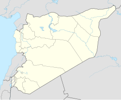
Al-Yadudah, Syria
Al-Yadudah
اليادودة | |
|---|---|
Village | |
| Coordinates: 32°39′55″N 36°3′40″E / 32.66528°N 36.06111°E | |
| Grid position | 249/231 PAL |
| Country | |
| Governorate | Daraa |
| District | Daraa |
| Subdistrict | Muzayrib |
| Population (2004)[1] | |
• Total | 8,967 |
| Time zone | UTC+2 (EET) |
| • Summer (DST) | UTC+3 (EEST) |
Al-Yadudah (Arabic: اليادودة) is a village in southern Syria, administratively part of the Daraa Governorate, located north-west of Daraa. Nearby localities include Tell Shihab to the west, Muzayrib to the northwest, Tafas to the west and Ataman to the east.
History
[edit]In the Ottoman tax registers of 1596, it was a village located the nahiya (subdistrict) of Butayna, Qada of Hawran. It had a population of 29 households and 21 bachelors, all Muslims. They paid a fixed tax-rate of 25% on agricultural products, including wheat, barley, summer crops, goats and beehives, in addition to occasional revenues; a total of 4,500 akçe.[2]
According to the Syria Central Bureau of Statistics, al-Yadudah had a population of 8,967 in the 2004 census.[1]
Syrian Civil War
[edit]On 13 September 2021, residents of the village struck a reconciliation deal with the Syrian Military. Allowing Syrian army and Russian forces to enter the village.[3]
On 11 May 2022, a Syrian soldier of the 4th Armoured Division was shot dead by insurgents in the village.[4]
References
[edit]- ^ a b General Census of Population and Housing 2004. Syria Central Bureau of Statistics (CBS). Daraa Governorate. (in Arabic)
- ^ Hütteroth and Abdulfattah, 1977, p. 214
- ^ "With a New Agreement, Regime Enters al-Yadudah in Daraa". The Syrian Observer. 14 September 2021.
- ^ "Security vacuum | Member of 4th Division assassinated in west Daraa countryside". Syrian Observatory for Human Rights. 11 May 2022.
Bibliography
[edit]- Hütteroth, W.-D.; Abdulfattah, K. (1977). Historical Geography of Palestine, Transjordan and Southern Syria in the Late 16th Century. Erlanger Geographische Arbeiten, Sonderband 5. Erlangen, Germany: Vorstand der Fränkischen Geographischen Gesellschaft. ISBN 3-920405-41-2.
External links
[edit]- Map of the town, Google Maps
- Cheik Meskin-map; 21L

