Condorcanqui province
Appearance
(Redirected from Condorcanqui)
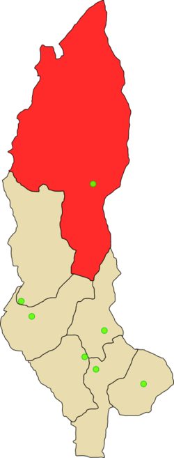
Condorcanqui | |
|---|---|
 Location of Condorcanqui in the Amazonas Region | |
| Country | Peru |
| Region | Amazonas |
| Capital | Santa María de Nieva |
| Government | |
| • Mayor | Hector Orlando Requejo Longinote |
| Area | |
• Total | 17,865.39 km2 (6,897.87 sq mi) |
| Population | |
• Total | 46,925 |
| • Density | 2.6/km2 (6.8/sq mi) |
| UBIGEO | 0104 |
| Website | www.municondorcanqui.gob.pe |
Condorcanqui is a province of the Amazonas Region, Peru. It was created by law 23832 of May 18, 1984, based on territories of the province of Bagua, covering the basins of the rivers Santiago, Cenepa and Marañon. The province was named in honor to Tupac Amaru II
Its principal route is the fluvial one, it lasts three days of navigation to come to Santa Maria de Nieva, capital of the province, furrowing the waters of the Marañón river.
Political division
[edit]Condorcanqui is divided into three districts, which are:
| District | Mayor |
|---|---|
| El Cenepa | Manuel Diaz Nashap |
| Nieva | Hector Orlando Requejo Longinote |
| Río Santiago | Segundo Flores Nahuarosa |


