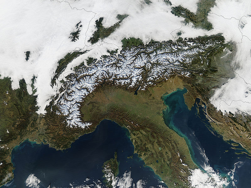
File:Alps satellite in winter.jpg
Appearance

Size of this preview: 800 × 600 pixels. Other resolutions: 320 × 240 pixels | 640 × 480 pixels | 1,024 × 768 pixels | 1,280 × 960 pixels | 2,400 × 1,800 pixels.
Original file (2,400 × 1,800 pixels, file size: 1.33 MB, MIME type: image/jpeg)
File history
Click on a date/time to view the file as it appeared at that time.
| Date/Time | Thumbnail | Dimensions | User | Comment | |
|---|---|---|---|---|---|
| current | 06:28, 27 October 2005 |  | 2,400 × 1,800 (1.33 MB) | Brian0918 | '''en:''' Heralding the oncoming winter, snow dusts the peaks of the Alps in this true-color Terra MODIS image from December 11, 2004. North of the Alps, clouds cover France, Switzerland, Liechtenstein, Austria, and Slovenia. South of the Alps, clear skie |
File usage
The following 4 pages use this file:
Global file usage
The following other wikis use this file:
- Usage on ast.wikipedia.org
- Usage on el.wikipedia.org
- Usage on es.wikipedia.org
- Usage on et.wikipedia.org
- Usage on frp.wikipedia.org
- Usage on fr.wikipedia.org
- Usage on gcr.wikipedia.org
- Usage on id.wikipedia.org
- Usage on ky.wikipedia.org
- Usage on nn.wikipedia.org
- Usage on no.wikipedia.org


