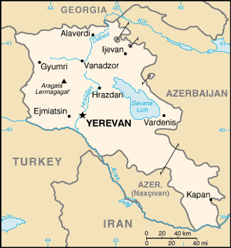
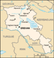
File:Am-map.png
Appearance
Am-map.png (330 × 354 pixels, file size: 12 KB, MIME type: image/png)
File history
Click on a date/time to view the file as it appeared at that time.
| Date/Time | Thumbnail | Dimensions | User | Comment | |
|---|---|---|---|---|---|
| current | 19:59, 11 October 2013 | 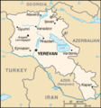 | 330 × 354 (12 KB) | Fry1989 | Revert political POV |
| 17:40, 21 March 2013 |  | 330 × 354 (12 KB) | Ankax Hayastan | Reverted to version as of 15:05, 26 February 2005 | |
| 12:30, 21 March 2013 |  | 330 × 354 (11 KB) | Ankax Hayastan | Reverted to version as of 08:17, 10 September 2010 | |
| 10:43, 12 November 2010 |  | 330 × 354 (12 KB) | Hoshie | Reverted to version as of 15:05, 26 February 2005: If you want to upload another version that doesn't show the exclaves, use another name | |
| 08:17, 10 September 2010 |  | 330 × 354 (11 KB) | Ankax Hayastan | (((Exclaves deleted according to official map at http://www.gov.am/en/regions/))) | |
| 15:05, 26 February 2005 |  | 330 × 354 (12 KB) | Alfio | CIA map of Armenia |
File usage
No pages on the English Wikipedia use this file (pages on other projects are not listed).
Global file usage
The following other wikis use this file:
- Usage on ar.wikipedia.org
- Usage on fr.wikipedia.org
- Usage on nl.wikipedia.org

