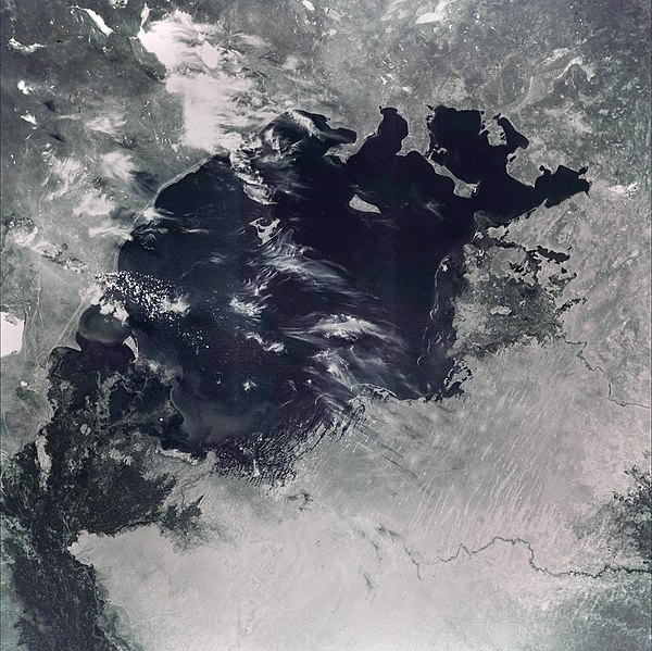
File:AralSeaAug1964-keyhole.jpg
Appearance

Size of this preview: 600 × 599 pixels. Other resolutions: 240 × 240 pixels | 481 × 480 pixels | 769 × 768 pixels | 1,025 × 1,024 pixels | 1,556 × 1,554 pixels.
Original file (1,556 × 1,554 pixels, file size: 1.11 MB, MIME type: image/jpeg)
File history
Click on a date/time to view the file as it appeared at that time.
| Date/Time | Thumbnail | Dimensions | User | Comment | |
|---|---|---|---|---|---|
| current | 20:11, 30 May 2022 |  | 1,556 × 1,554 (1.11 MB) | Italyoz484 | Fixed haze. |
| 14:56, 9 September 2021 |  | 1,556 × 1,554 (1.08 MB) | LightandDark2000 | Reverted to version as of 06:33, 5 August 2021 (UTC) That looks worse. | |
| 18:21, 5 September 2021 |  | 800 × 800 (105 KB) | PineappIed | more accurate depiction | |
| 18:16, 5 September 2021 |  | 3,930 × 3,930 (2.9 MB) | PineappIed | ||
| 06:33, 5 August 2021 |  | 1,556 × 1,554 (1.08 MB) | Italyoz484 | coloration | |
| 10:53, 1 October 2014 |  | 3,930 × 3,930 (2.9 MB) | Szczureq | Full resolution found at NASA Earth Observatory (http://earthobservatory.nasa.gov/IOTD/view.php?id=77193) | |
| 22:52, 10 January 2008 |  | 450 × 450 (35 KB) | File Upload Bot (Magnus Manske) | {{BotMoveToCommons|en.wikipedia}} {{Information |Description={{en|This image of the Aral Sea was acquired in August of 1964 by a United States Argon intelligence mapping/geodesy satellite. KH-5 Mission 9064-A (incorrectly mislabeled 9066-A in the USGS |
File usage
No pages on the English Wikipedia use this file (pages on other projects are not listed).
Global file usage
The following other wikis use this file:
- Usage on ba.wikipedia.org
- Usage on de.wikipedia.org
- Usage on it.wikipedia.org
- Usage on km.wikipedia.org
- Usage on nn.wikipedia.org
- Usage on pl.wikipedia.org
- Usage on ru.wikipedia.org
- Usage on ta.wikipedia.org


