File:Arktocara map.png
Appearance

Size of this preview: 800 × 323 pixels. Other resolutions: 320 × 129 pixels | 640 × 258 pixels | 1,024 × 413 pixels | 2,093 × 845 pixels.
Original file (2,093 × 845 pixels, file size: 849 KB, MIME type: image/png)
File history
Click on a date/time to view the file as it appeared at that time.
| Date/Time | Thumbnail | Dimensions | User | Comment | |
|---|---|---|---|---|---|
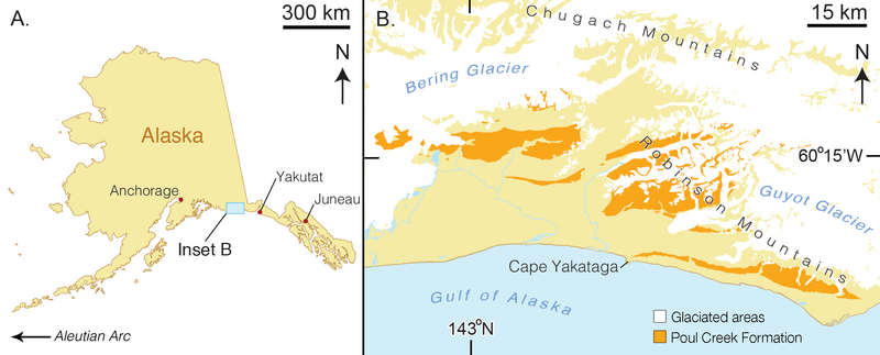
| current | 04:39, 25 November 2017 | 2,093 × 845 (849 KB) | FunkMonk | =={{int:filedesc}}== {{Information |description={{en|1=Map of type locality for Arktocara yakataga (USNM 214830). (A) a map of the state of Alaska, showing major Alaskan cities. (B) simplified geologic map of the Yakutat City and Borough based on the U... |
File usage
The following 3 pages use this file:
