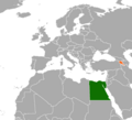
File:Egypt Armenia Locator.png
Appearance

Size of this preview: 659 × 600 pixels. Other resolutions: 264 × 240 pixels | 527 × 480 pixels | 844 × 768 pixels | 1,160 × 1,056 pixels.
Original file (1,160 × 1,056 pixels, file size: 80 KB, MIME type: image/png)
File history
Click on a date/time to view the file as it appeared at that time.
| Date/Time | Thumbnail | Dimensions | User | Comment | |
|---|---|---|---|---|---|
| current | 04:29, 24 June 2022 |  | 1,160 × 1,056 (80 KB) | Aquintero82 | Updated map |
| 17:24, 14 January 2017 |  | 259 × 163 (18 KB) | عادل | Correction of Egypt borders | |
| 01:40, 3 July 2014 |  | 259 × 163 (5 KB) | OgreBot | (BOT): Reverting to most recent version before archival | |
| 01:40, 3 July 2014 |  | 1,160 × 1,056 (47 KB) | OgreBot | (BOT): Uploading old version of file from en.wikipedia; originally uploaded on 2013-09-24 18:30:12 by Fitzcarmalan | |
| 20:15, 30 June 2014 |  | 259 × 163 (5 KB) | Arthunter | Transferred from en.wikipedia |
File usage
The following 2 pages use this file:
Global file usage
The following other wikis use this file:
- Usage on ar.wikipedia.org
- Usage on az.wikipedia.org
- Usage on eo.wikipedia.org
- Usage on es.wikipedia.org
- Usage on fa.wikipedia.org
- Usage on he.wikipedia.org
- Usage on hy.wikipedia.org
- Usage on ka.wikipedia.org
- Usage on ru.wikipedia.org
- Usage on uz.wikipedia.org
- Usage on www.wikidata.org

