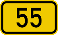
File:Bundesstraße 55 number.svg
Appearance

Size of this PNG preview of this SVG file: 200 × 120 pixels. Other resolutions: 320 × 192 pixels | 640 × 384 pixels | 1,024 × 614 pixels | 1,280 × 768 pixels | 2,560 × 1,536 pixels.
Original file (SVG file, nominally 200 × 120 pixels, file size: 2 KB)
File history
Click on a date/time to view the file as it appeared at that time.
| Date/Time | Thumbnail | Dimensions | User | Comment | |
|---|---|---|---|---|---|
| current | 19:02, 19 January 2015 |  | 200 × 120 (2 KB) | De728631 | Unifying colour and code (by Antonsusi) |
| 21:19, 15 September 2005 |  | 200 × 120 (3 KB) | 3247's Image Wizard | 055.svg {{Deutsch}} Bundesdeutsche Bundesstraßennummer. Automatisch erzeugt durch 3247.<br />{{English}} German Federal Road (Bundesstraße) number signet. Created automatically by 3247 |
File usage
The following 14 pages use this file:
- Bundesautobahn 1
- Bundesautobahn 4
- Bundesautobahn 44
- Bundesautobahn 559
- Bundesstraße 1
- Bundesstraße 55
- Bundesstraße 8
- Innenstadt, Cologne
- List of highways numbered 55
- List of streets in Cologne
- Wikipedia:Bundesstraße article format
- Template:Bundesautobahn 1 route map
- Template:Bundesautobahn 4 route map
- Template:Bundesstraße 1
Global file usage
The following other wikis use this file:
- Usage on cs.wikipedia.org
- Usage on de.wikipedia.org
- Deutz (Köln)
- Liste der Bundesautobahnen in Deutschland
- Bundesautobahn 44
- Bundesautobahn 1
- Bundesautobahn 46
- Bundesstraße 236
- Liste der Bundesstraßen in Deutschland
- Bundesstraße 1
- Bundesautobahn 4
- Bundesautobahn 559
- Bundesautobahn 45
- Bundesstraße 54
- Bundesstraße 61
- Bundesstraße 8
- Bundesautobahn 61
- Bundesstraße 9
- Elsdorf (Rheinland)
- Bundesstraße 511
- Bundesstraße 516
- Bundesstraße 484
- Bundesstraße 477
- Kölner Autobahnring
- Altstadt-Süd
- Braunsfeld (Köln)
- Junkersdorf (Köln)
- Lindenthal (Köln)
- Lövenich (Köln)
- Müngersdorf
- Weiden (Köln)
- Neustadt-Süd (Köln)
- Bundesstraße 264
- Bundesstraße 58
- Bundesstraße 55
- Straßenbaulast
- Liste der Rheinbrücken
- Kalk (Köln)
- Kölner Stadtautobahn
- Merheim
- Severinsbrücke
- Höhenberg (Köln)
- Bundesautobahn 47
- Brück (Köln)
- Vorlage:Infobox Stadtteil von Köln
- Bundesautobahn 54
- Ortsstraße
- Innerortsstraße
- Vorlage:Infobox Stadtteil von Köln/Doku
View more global usage of this file.

