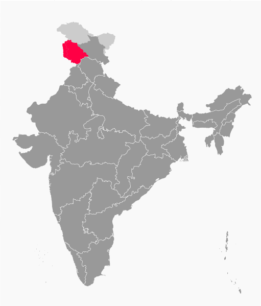
File:IN-JK (2019, claimed).svg
Appearance

Size of this PNG preview of this SVG file: 511 × 599 pixels. Other resolutions: 205 × 240 pixels | 410 × 480 pixels | 655 × 768 pixels | 874 × 1,024 pixels | 1,748 × 2,048 pixels | 1,594 × 1,868 pixels.
Original file (SVG file, nominally 1,594 × 1,868 pixels, file size: 237 KB)
File history
Click on a date/time to view the file as it appeared at that time.
| Date/Time | Thumbnail | Dimensions | User | Comment | |
|---|---|---|---|---|---|
| current | 14:36, 2 November 2019 |  | 1,594 × 1,868 (237 KB) | RaviC | adjustments made following publication of official boundaries of new UTs |
| 14:57, 14 August 2019 |  | 1,594 × 1,868 (232 KB) | RaviC | =={{int:filedesc}}== {{Information |description={{en|1=Map showing the bifurcated of the union territory of Jammu and Kashmir in 2019 shown in red. Claimed, but not administered portions included. Uses File:India grey.svg.}} |date=2019-08-14 |source={{own}} |author=RaviC |permission= |other versions= }} =={{int:license-header}}== {{self|cc-by-sa-4.0}} Category:SVG locator maps of states in India (red and dark grey location map scheme) |
File usage
The following page uses this file:
Global file usage
The following other wikis use this file:
- Usage on es.wikipedia.org
- Usage on incubator.wikimedia.org
- Usage on mr.wikipedia.org
- Usage on ta.wikipedia.org
- Usage on te.wikipedia.org
