Jump to content

File:Isola Formica.jpg

Page contents not supported in other languages.
This is a file from the Wikimedia Commons
From Wikipedia, the free encyclopedia

Original file (3,154 × 1,719 pixels, file size: 2.75 MB, MIME type: image/jpeg)

Description
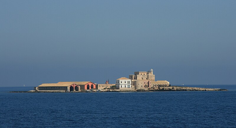
Italiano: Isola Formica, con la tonnara. Isole Egadi, tra Trapani e Favignana, Sicily
Deutsch: Isola Formica (ital.Ameise) ist eine der kleineren Ägadischen Inseln. Sie liegt zwischen der Insel Levanzo und der Küstenstadt Trapani und gehört zu der Gemeinde Favignana. Auf ihr finden sich noch Überreste einer alten Tonnara und einem Kastell mit Leuchtturm. Die Insel ist im Privatbesitz und dient einer Stiftung als Rehabilitationszentrum für drogenabhängige Jugendliche.
Date
Source originally posted to Flickr as Tonnara?
Author Alessio Milan
Permission
(Reusing this file)
This image, which was originally posted to Flickr, was uploaded to Commons using Flickr upload bot on 11 September 2008, 07:24 by Pitichinaccio. On that date, it was confirmed to be licensed under the terms of the license indicated.
w:en:Creative Commons
attribution share alike
This file is licensed under the Creative Commons Attribution-Share Alike 2.0 Generic license.
You are free:
  • to share – to copy, distribute and transmit the work
  • to remix – to adapt the work
Under the following conditions:
  • attribution – You must give appropriate credit, provide a link to the license, and indicate if changes were made. You may do so in any reasonable manner, but not in any way that suggests the licensor endorses you or your use.
  • share alike – If you remix, transform, or build upon the material, you must distribute your contributions under the same or compatible license as the original.
OpenStreetMap
InfoField
Way 10364843
Object location37° 59′ 20.57″ N, 12° 25′ 30.53″ E Kartographer map based on OpenStreetMap.View this and other nearby images on: OpenStreetMapinfo

Captions

Add a one-line explanation of what this file represents

Items portrayed in this file

depicts

9 July 2007

37°59'20.5710"N, 12°25'30.5314"E

0.003125 second

85 millimetre

File history

Click on a date/time to view the file as it appeared at that time.

Date/TimeThumbnailDimensionsUserComment
current08:46, 26 March 2016Thumbnail for version as of 08:46, 26 March 20163,154 × 1,719 (2.75 MB)Civa61Reverted to version as of 08:42, 26 March 2016 (UTC)
08:45, 26 March 2016Thumbnail for version as of 08:45, 26 March 20163,154 × 1,719 (2.75 MB)Civa61Restringo
08:42, 26 March 2016Thumbnail for version as of 08:42, 26 March 20163,154 × 1,719 (2.75 MB)Civa61Restringo
07:24, 11 September 2008Thumbnail for version as of 07:24, 11 September 20083,888 × 2,592 (2.87 MB)Flickr upload botUploaded from http://flickr.com/photo/24305255@N00/2252687370 using Flickr upload bot

Global file usage

Metadata