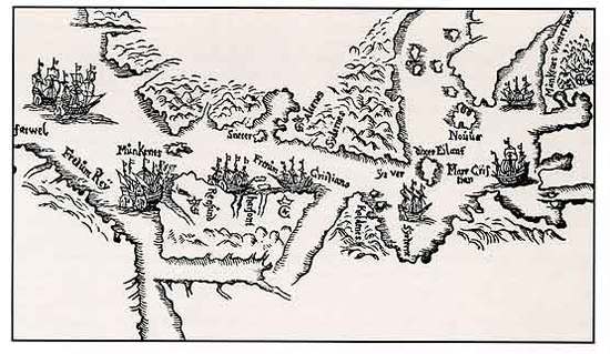
File:Jens Munk map 1624.jpg
Appearance
Jens_Munk_map_1624.jpg (550 × 319 pixels, file size: 41 KB, MIME type: image/jpeg)
File history
Click on a date/time to view the file as it appeared at that time.
| Date/Time | Thumbnail | Dimensions | User | Comment | |
|---|---|---|---|---|---|
| current | 00:08, 19 May 2011 |  | 550 × 319 (41 KB) | Ramblersen | {{Information |Description ={{en|1=A map hand-drawn by Jens Munk in 1624 of the area between Cape Farewell (Greenland) and Hudson Bay, seen from the north}} |Source =Tromsø University Library |Author =Jens Munk |Date =1624 |P |
File usage
No pages on the English Wikipedia use this file (pages on other projects are not listed).
Global file usage
The following other wikis use this file:
- Usage on ca.wikipedia.org
- Usage on es.wikipedia.org
- Usage on fr.wikipedia.org
- Usage on fy.wikipedia.org
- Usage on it.wikipedia.org
- Usage on nn.wikipedia.org
- Usage on no.wikipedia.org
- Usage on ru.wikipedia.org
- Usage on sv.wikipedia.org


