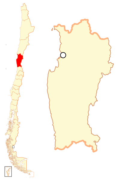
File:Mapa loc Coquimbo.svg
Appearance

Size of this PNG preview of this SVG file: 400 × 600 pixels. Other resolutions: 160 × 240 pixels | 320 × 480 pixels | 512 × 768 pixels | 682 × 1,024 pixels | 1,365 × 2,048 pixels.
Original file (SVG file, nominally 400 × 600 pixels, file size: 1.13 MB)
File history
Click on a date/time to view the file as it appeared at that time.
| Date/Time | Thumbnail | Dimensions | User | Comment | |
|---|---|---|---|---|---|
| current | 22:39, 5 September 2018 |  | 400 × 600 (1.13 MB) | Janitoalevic | Ñuble Region |
| 23:14, 20 August 2017 |  | 400 × 600 (1.01 MB) | Janitoalevic | Reverted to version as of 05:34, 12 November 2007 (UTC) | |
| 04:22, 20 August 2017 |  | 400 × 600 (1.06 MB) | Janitoalevic | Added Ñuble Region | |
| 05:34, 12 November 2007 |  | 400 × 600 (1.01 MB) | B1mbo | {{Information |Description= {{es|Mapa localizador de la IV Región de Coquimbo}} |Source=own work |Date=12 de noviembre, 2007 |Author=B1mbo |Permission={{self|cc-by-sa-2.5}} |other_versions= }} {{User:B1mbo/Ch |
File usage
The following 21 pages use this file:
Global file usage
The following other wikis use this file:
- Usage on ba.wikipedia.org
- Usage on bg.wikipedia.org
- Usage on da.wikipedia.org
- Usage on de.wikipedia.org
- Usage on diq.wikipedia.org
- Usage on es.wikipedia.org
- Usage on eu.wikipedia.org
- Usage on fi.wikipedia.org
View more global usage of this file.
