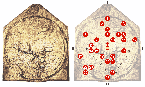
File:Mappa mundi Hereford 1300 explained.png
Appearance
Mappa_mundi_Hereford_1300_explained.png (612 × 369 pixels, file size: 50 KB, MIME type: image/png)
File history
Click on a date/time to view the file as it appeared at that time.
| Date/Time | Thumbnail | Dimensions | User | Comment | |
|---|---|---|---|---|---|
| current | 20:25, 28 February 2007 |  | 612 × 369 (50 KB) | I.R. Annie IP. | |
| 14:29, 26 February 2007 |  | 607 × 697 (131 KB) | I.R. Annie IP. | {{Information |Description=Image:Hereford Mappa Mundi 1300.jpg, edited, some details explained. At the center of the map: Jerusalem, crowned by the Crucifix. 1 - Paradise 2 - The fabulous Island of Taphana, sometimes (possibly mis-)interpreted as Sri La |
File usage
The following 2 pages use this file:
Global file usage
The following other wikis use this file:
- Usage on ar.wikipedia.org
- Usage on cs.wikipedia.org
- Usage on de.wikipedia.org
- Usage on et.wikipedia.org
- Usage on fr.wikipedia.org
- Usage on he.wikipedia.org
- Usage on it.wikipedia.org
- Usage on pl.wikipedia.org
- Usage on sl.wikipedia.org
- Usage on uk.wikipedia.org


