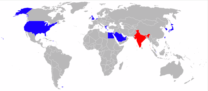
File:OperatorsofAh-64.png
Appearance

Size of this preview: 800 × 351 pixels. Other resolutions: 320 × 140 pixels | 640 × 281 pixels | 1,425 × 625 pixels.
Original file (1,425 × 625 pixels, file size: 40 KB, MIME type: image/png)
File history
Click on a date/time to view the file as it appeared at that time.
| Date/Time | Thumbnail | Dimensions | User | Comment | |
|---|---|---|---|---|---|
| current | 16:46, 27 May 2016 |  | 1,425 × 625 (40 KB) | 木の枝 | +India, South korea's Color Change to Blue |
| 07:42, 6 November 2013 |  | 1,425 × 625 (50 KB) | Berg2 | Update: Taiwan received first Apaches | |
| 00:36, 18 April 2013 |  | 1,425 × 625 (50 KB) | Evan.oltmanns | Added South Korea to the map as a party with equipment on order, noted by the color red. Also changed Taiwan to red to agree with South Korea color. | |
| 03:34, 23 April 2010 |  | 1,425 × 625 (30 KB) | Noclador | update + standard colors | |
| 18:15, 3 December 2009 |  | 1,427 × 628 (48 KB) | Qazmlp1029 | {{Information |Description=A blank map of the world as of 2008, with country outlines, for making country locator maps. This map uses the Robinson projection centered on the Greenwich Prime Meridian and includes various [[:en: |
File usage
No pages on the English Wikipedia use this file (pages on other projects are not listed).
Global file usage
The following other wikis use this file:
- Usage on bs.wikipedia.org
- Usage on pl.wikipedia.org
- Usage on ro.wikipedia.org
- Usage on uk.wikipedia.org
- Usage on zh.wikipedia.org
