Jump to content

File:SJU International Caribbean Region Routes.gif

Page contents not supported in other languages.
This is a file from the Wikimedia Commons
From Wikipedia, the free encyclopedia

SJU_International_Caribbean_Region_Routes.gif (540 × 540 pixels, file size: 16 KB, MIME type: image/gif)

Summary

Description
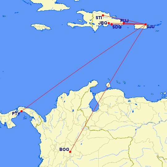
English: This is a route map for Luis Muñoz Marín International Airport in San Juan, Puerto Rico to Caribbean, South and Central American destinations as of November 2016.
Date
Source http://www.gcmap.com/mapui?P=SJU-BOG%2C+SJU-PTY%2C+SJU-CUN%2C+%0D%0A%0D%0ASJU-AUA%2C+SJU-CUR%2C+SJU-FDF%2C+SJU-PTP%2C+SJU-SXM%2C++SJU-ANU%2C+SJU-DOM%2C+SJU-AXA%2C+SJU-NEV%2C+SJU-SKB%2C+SJU-SBH%0D%0A%0D%0ASJU-JBQ%2C+SJU-SDQ%2C+SJU-PUJ%2C+SJU-STI%2C+SJU-POP%2C+SJU-LRM%2C%0D%0A%0D%0A+SJU-PLS%2C%0D%0A&MS=wls&DU=mi
Author Great Circle Mapper (Karl L. Swartz)
Permission
(Reusing this file)
http://www.gcmap.com/faq/using#wikipedia

Credits: http://www.gcmap.com/credits

Licensing

© The copyright holder of this file allows anyone to use it for any purpose, provided that the copyright holder is properly attributed. Redistribution, derivative work, commercial use, and all other use is permitted.

Captions

Add a one-line explanation of what this file represents

Items portrayed in this file

depicts

12 November 2016

image/gif

File history

Click on a date/time to view the file as it appeared at that time.

Date/TimeThumbnailDimensionsUserComment
current03:41, 16 November 2019Thumbnail for version as of 03:41, 16 November 2019540 × 540 (16 KB)Khaled98As of 2019
01:25, 26 November 2016Thumbnail for version as of 01:25, 26 November 2016720 × 360 (19 KB)JAlvarezPRUser created page with UploadWizard
No pages on the English Wikipedia use this file (pages on other projects are not listed).

Global file usage

The following other wikis use this file:

Metadata