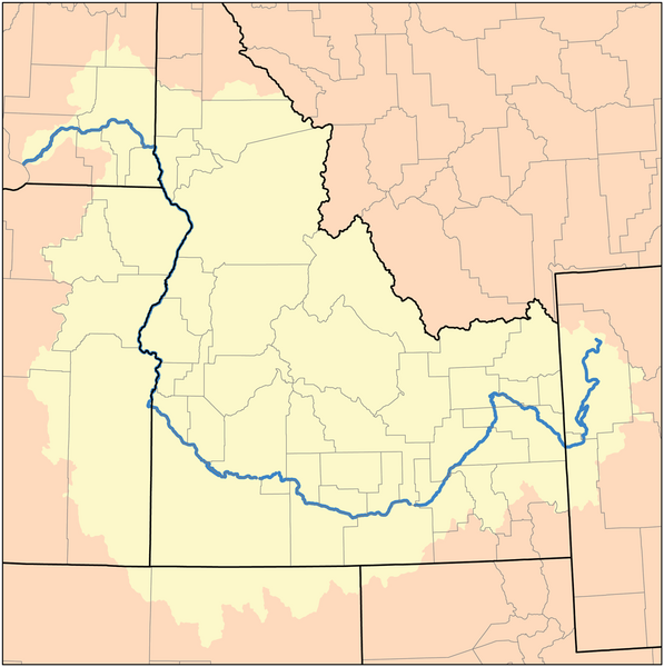
File:Snake watershed.png
Appearance

Size of this preview: 597 × 600 pixels. Other resolutions: 239 × 240 pixels | 478 × 480 pixels | 1,000 × 1,005 pixels.
Original file (1,000 × 1,005 pixels, file size: 296 KB, MIME type: image/png)
File history
Click on a date/time to view the file as it appeared at that time.
| Date/Time | Thumbnail | Dimensions | User | Comment | |
|---|---|---|---|---|---|
| current | 22:52, 22 February 2010 |  | 1,000 × 1,005 (296 KB) | Kmusser | increased resolution |
| 22:36, 5 May 2007 |  | 189 × 190 (15 KB) | DanMS | Trimmed excess white space around image and uploaded same again. | |
| 19:00, 16 November 2005 |  | 200 × 200 (15 KB) | Kmusser | ||
| 15:31, 8 September 2005 |  | 200 × 200 (36 KB) | Kmusser | ||
| 12:38, 9 August 2005 |  | 200 × 200 (17 KB) | Kmusser | This is a map of the Tennessee River Watershed. I, Karl Musser, created it based on USGS data. {{GFDL}} Category:Maps of rivers |
File usage
The following page uses this file:
Global file usage
The following other wikis use this file:
- Usage on af.wikipedia.org
- Usage on azb.wikipedia.org
- Usage on fi.wikipedia.org
- Usage on fy.wikipedia.org
- Usage on io.wikipedia.org
- Usage on kk.wikipedia.org
- Usage on lt.wikipedia.org
- Usage on nl.wikipedia.org
- Usage on pt.wikipedia.org
- Usage on sl.wikipedia.org
- Usage on sv.wikipedia.org
- Usage on sw.wikipedia.org
- Usage on uk.wikipedia.org
- Usage on zh.wikipedia.org
