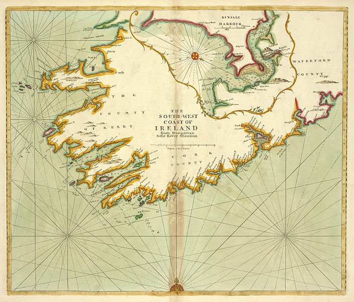
File:Southwest Ireland Thornton.jpg
Appearance

Size of this preview: 704 × 600 pixels. Other resolutions: 282 × 240 pixels | 563 × 480 pixels | 901 × 768 pixels | 1,202 × 1,024 pixels | 2,404 × 2,048 pixels | 2,873 × 2,448 pixels.
Original file (2,873 × 2,448 pixels, file size: 4.32 MB, MIME type: image/jpeg)
File history
Click on a date/time to view the file as it appeared at that time.
| Date/Time | Thumbnail | Dimensions | User | Comment | |
|---|---|---|---|---|---|
| current | 08:59, 23 November 2009 |  | 2,873 × 2,448 (4.32 MB) | Jujutacular | {{Information |Description={{en|1=Nautical map of the coast of southwest Ireland from Dungarvan to the River Shannon by the cartographer Samuel Thornton circa 1702-1707.}} |Source={{NYPL-image-DigitalID|1640582}}</br>Location: Stephen A. Schwarzman Buildi |
File usage
No pages on the English Wikipedia use this file (pages on other projects are not listed).
Global file usage
The following other wikis use this file:
- Usage on et.wikipedia.org
- Usage on eu.wikipedia.org
- Usage on ga.wikipedia.org
- Usage on sh.wikipedia.org
