File:Sunderland station diagram (white).png
Page contents not supported in other languages.
Tools
Actions
General
In other projects
Appearance
Sunderland_station_diagram_(white).png (368 × 524 pixels, file size: 4 KB, MIME type: image/png)
| This is a file from the Wikimedia Commons. Information from its description page there is shown below. Commons is a freely licensed media file repository. You can help. |
| DescriptionSunderland station diagram (white).png |
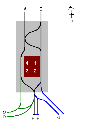
English: This is a diagram of the track layout at Sunderland station, created by me using based on my own photographs (most, but not all of which, are (or will shortly be) available in Category:Sunderland station at the Wikimedia Commons. My interpretation has been confirmed with the diagram on the Tyne and Wear Transport Group (a Tyne and Wear Metro enthusiast group) MSN Group [1].
Key
|
||||||||
| Date | |||||||||
| Source | Own work | ||||||||
| Author | Chris McKenna (Thryduulf (talk)) | ||||||||
| Permission (Reusing this file) |
This file is licensed under the Creative Commons Attribution 1.0 Generic license.
This file is licensed under the Creative Commons Attribution 2.0 UK: England & Wales license.
 This file is licensed under the Creative Commons Attribution 2.5 Generic license.
|
||||||||
| Other versions |
 |
Captions
Add a one-line explanation of what this file represents
Items portrayed in this file
depicts
2 December 2005
File history
Click on a date/time to view the file as it appeared at that time.
| Date/Time | Thumbnail | Dimensions | User | Comment | |
|---|---|---|---|---|---|
| current | 21:44, 2 December 2005 |  | 368 × 524 (4 KB) | Thryduulf | This is a diagram of the track layout at Sunderland station, created by me using based on my own photographs (most, but not all of which, are (or will shortly be) available in Category:Sunderland at the Wikimedia Commons. |
File usage
No pages on the English Wikipedia use this file (pages on other projects are not listed).


