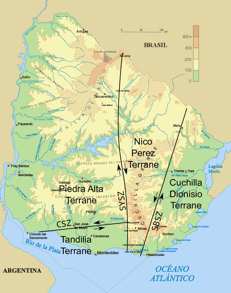
File:Uruguay fisico-SZ.png
Appearance

Size of this preview: 471 × 599 pixels. Other resolutions: 188 × 240 pixels | 377 × 480 pixels | 603 × 768 pixels | 1,100 × 1,400 pixels.
Original file (1,100 × 1,400 pixels, file size: 519 KB, MIME type: image/png)
File history
Click on a date/time to view the file as it appeared at that time.
| Date/Time | Thumbnail | Dimensions | User | Comment | |
|---|---|---|---|---|---|
| current | 15:24, 6 January 2016 |  | 1,100 × 1,400 (519 KB) | Fama Clamosa | {{Information |Description=Topographic map of Uruguay with shear zones and terranes |Source=File:Uruguay_fisico.png; geology after Gaucher et al. 2008, Fig. 1. |Date=January 6, 2016 |Author= Jordevi; [[User:Fama Clamosa|Fama Clamo... |
File usage
The following 5 pages use this file:
Global file usage
The following other wikis use this file:
- Usage on ar.wikipedia.org
- Usage on es.wikipedia.org
- Usage on hr.wikipedia.org
- Usage on it.wikipedia.org
- Usage on pt.wikipedia.org
