Azaz Subdistrict
Appearance
(Redirected from Nahiya Azaz)
Azaz Subdistrict
ناحية مركز أعزاز | |
|---|---|
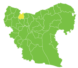
 Location of Azaz Subdistrict within Aleppo Governorate | |
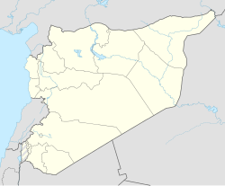
| Coordinates (Azaz): 36°34′54″N 37°04′20″E / 36.5817°N 37.0722°E | |
| Country | |
| Governorate | Aleppo |
| District | Azaz District |
| Seat | Azaz |
| Area | |
• Total | 180.12 km2 (69.54 sq mi) |
| Population (2004)[1] | 47,570 |
| Geocode | SY020400 |
Azaz Subdistrict (Arabic: ناحية مركز أعزاز, romanized: Nāḥiyah A‘zāz) is a subdistrict of Azaz District in northwestern Aleppo Governorate of northern Syria. Administrative centre is the city of Azaz. Neighbouring subdistricts are Sawran to the east, Tell Rifaat to the south, and the subdistricts Afrin and Bulbul of Afrin District to the west or southwest, respectively. To the north is the Kilis Province of Turkey.
At the 2004 census, the subdistrict had a population of 47,570.[1]
Cities, towns and villages
[edit]| PCode | Name | Population |
|---|---|---|
| C1564 | Azaz | 31,623 |
| C1575 | Kaljibrin | 3,291 |
| C1568 | Kafr Kalbin | 2,146 |
| C1569 | Menagh | 2,128 |
| C1561 | Salama | 1,408 |
| C1573 | Nayarah | 1,337 |
| C1570 | Maraanaz | 959 |
| C1562 | Jarez | 945 |
| C1556 | Sijraz | 735 |
| C1571 | Yahmul | 612 |
| C1566 | Shamarin | 506 |
| C1574 | Ma'arin | 334 |
| C1572 | Naddah | 305 |
| C1565 | Yazebax | 252 |
| C1567 | Kafr Khasher | 246 |
| C1557 | Shamarikh | 226 |
| C1563 | al-Malikiyah | 177 |
| C1559 | Tulayl ash-Sham | 176 |
| C1560 | Fayruziyah | 88 |
| C1558 | Tatiyah | 76 |
References
[edit]- ^ a b "2004 Census Data for Nahiya Azaz" (in Arabic). Syrian Central Bureau of Statistics. Archived from the original on 8 December 2015. Retrieved 15 October 2015. Also available in English: UN OCHA. "2004 Census Data". Humanitarian Data Exchange. Archived from the original on 2015-12-08. Retrieved 4 December 2015.


