Peñalsordo
Appearance
Peñalsordo, Spain | |
|---|---|
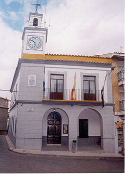
 Main facade of the Peñalsordo town hall, Badajoz. | |
 | |
| Country | Spain |
| Autonomous community | Extremadura |
| Province | Badajoz |
| Municipality | Peñalsordo |
| Area | |
• Total | 47 km2 (18 sq mi) |
| Elevation | 456 m (1,496 ft) |
| Population (2018)[1] | |
• Total | 949 |
| • Density | 20/km2 (52/sq mi) |
| Time zone | UTC+1 (CET) |
| • Summer (DST) | UTC+2 (CEST) |
Peñalsordo is a municipality located in the province of Badajoz, Extremadura, Spain. According to the 2010 census (INE), the municipality has a population of 1180 inhabitants.
References
[edit]- ^ Municipal Register of Spain 2018. National Statistics Institute.
38°49′N 5°07′W / 38.817°N 5.117°W


