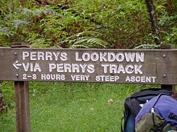
Perrys Lookdown
Appearance
(Redirected from Perry's Lookdown)


Perry's Lookdown is situated on the edge of the Grose Valley in the Blue Mountains, Australia.[1] It is believed to have been named by Frederick Eccleston Du Faur after either Samuel Augustus Perry or a local innkeeper.[2] Free campsites (five individual sites) are adjacent to the car park.[3] The Blue Gum Forest is often accessed by foot from here, 656 vertical metres below the lookdown. The road to Blackheath is unsealed.[4]
References
[edit]- ^ "Bushwalking on the Perrys Lookdown". Walking near Sydney. Wild Walks. Retrieved 7 May 2012.
- ^ Keats, Michael & Fox, Brian (2008) [1973]. The Upper Grose Valley, Bushwalkers Business (paperback ed.). Pymble, NSW: Keats Holdings. p. 469. ISBN 9780646473192.
{{cite book}}: CS1 maint: multiple names: authors list (link) - ^ "Perrys lookdown campground".
- ^ "NSW Place and Road Naming Proposals System". proposals.gnb.nsw.gov.au. Retrieved 19 May 2022.
33°35.979′S 150°20.803′E / 33.599650°S 150.346717°E
