Jump to content

Template:Infobox Indian state or territory/testcases

Coordinates: 12°58′N 77°30′E / 12.97°N 77.50°E / 12.97; 77.50
From Wikipedia, the free encyclopedia

Maharashtra ( Demo )

[edit]
Side by side comparison
{{Infobox Indian state or territory}}{{Infobox Indian state or territory/sandbox}}
Maharashtra
Etymology: Mahā ("great") and Rāshtra ("nation/dominion")
Motto
Pratipaccandralēkhēva vardhiṣṇurviśva vanditā Mahārāṣṭrasya rājyasya mudrā bhadrāya rājatē
Anthem: Jai Jai Maharashtra Maza
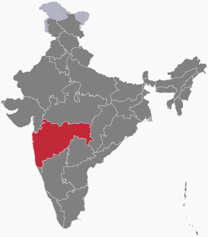
The map of India showing Maharashtra
Location of Maharashtra in India
Coordinates: 18°58′N 72°49′E / 18.97°N 72.82°E / 18.97; 72.82
CountryIndia
RegionWest India
Before wasState of Bombay (1950–1960)
Formation
(by bifurcation)
1 May 1960
CapitalMumbai
Nagpur (winter)
Largest cityMumbai
Largest metroMumbai Metropolitan Region
Districts36 (6 divisions)
Government
 • BodyGovernment of Maharashtra
 • GovernorBhagat Singh Koshyari
 • Chief ministerEknath Shinde (BSS)
State LegislatureBicemiral
 • CouncilMaharashtra Legislative Council (78 seats)
 • AssemblyMaharashtra Legislative Assembly (228 seats)
National ParliamentParliament of India
 • Rajya Sabha19 seats
 • Lok Sabha48 seats
High CourtBombay High Court
Area
 • Total
307,713 km2 (118,809 sq mi)
 • Rank3rd
Elevation
14 m (46 ft)
Population
 (2011)
 • Total
112,374,333
 • Rank2nd
 • Density370/km2 (1,000/sq mi)
 • Urban
45.22%
 • Rural
54.78%
DemonymMaharashtrian
Language
 • OfficialMarathi
GDP
 • Total (2021–22 est)31.97 trillion (US$380 billion)
 • Rank1st
 • Per capita225,073 (US$2,700) (14th)
Time zoneUTC+05:30 (IST)
ISO 3166 codeIN-MH
Vehicle registrationMH
HDI (2022)0.750 (9th)
Literacy (2017)84.8%
Sex ratio (2021)966
Websitemaharashtra.gov.in
Symbols of Maharashtra
SongJai Jai Maharashtra Maza
Foundation dayMaharashtra Day
BirdYellow-footed green pigeon
ButterflyBlue mormon
FishRohu
FlowerJarul
TreeMango tree
State highway mark
State highway of Maharashtra
MH SH1-MH SH368
List of Indian state symbols
Joint High Court with Goa
Maharashtra
Etymology: Mahā ("great") and Rāshtra ("nation/dominion")
Motto
Pratipaccandralēkhēva vardhiṣṇurviśva vanditā Mahārāṣṭrasya rājyasya mudrā bhadrāya rājatē
Anthem: Jai Jai Maharashtra Maza
The map of India showing Maharashtra
Location of Maharashtra in India
Coordinates: 18°58′N 72°49′E / 18.97°N 72.82°E / 18.97; 72.82
Country India
RegionWest India
Before wasState of Bombay (1950–1960)
Formation
(by bifurcation)
1 May 1960
As province{{{formation_date5}}}
CapitalMumbai
Nagpur (winter)
Largest cityMumbai
Largest metroMumbai Metropolitan Region
Districts36 (6 divisions)
Government
 • BodyGovernment of Maharashtra
 • GovernorBhagat Singh Koshyari
 • Chief ministerEknath Shinde (BSS)
State LegislatureBicemiral
 • CouncilMaharashtra Legislative Council (78 seats)
 • AssemblyMaharashtra Legislative Assembly (228 seats)
National ParliamentParliament of India
 • Rajya Sabha19 seats
 • Lok Sabha48 seats
High CourtBombay High Court
Area
 • Total
307,713 km2 (118,809 sq mi)
 • Rank3rd
Elevation
14 m (46 ft)
Population
 (2011)
 • Total
112,374,333
 • Rank2nd
 • Density370/km2 (1,000/sq mi)
 • Urban
45.22%
 • Rural
54.78%
DemonymMaharashtrian
Language
 • OfficialMarathi
GDP
 • Total (2021–22 est)31.97 trillion (US$380 billion)
 • Rank1st
 • Per capita225,073 (US$2,700) (14th)
Time zoneUTC+05:30 (IST)
ISO 3166 codeIN-MH
Vehicle registrationMH
HDI (2022)0.750 (9th)
Literacy (2017)84.8%
Sex ratio (2021)966
Websitemaharashtra.gov.in
Symbols of Maharashtra
SongJai Jai Maharashtra Maza
Foundation dayMaharashtra Day
BirdYellow-footed green pigeon
ButterflyBlue mormon
FishRohu
FlowerJarul
TreeMango tree
State highway mark
State highway of Maharashtra
MH SH1-MH SH368
List of Indian state symbols
Joint High Court with Goa


Karnataka ( Currently Used )

[edit]
Side by side comparison
{{Infobox Indian state or territory}}{{Infobox Indian state or territory/sandbox}}
Karnataka
Etymology: Land of Kannadigas
Nickname: 
"IT Capital of India"
Motto
Satyameva Jayate (Truth alone triumphs)
Anthem: Jaya Bharata Jananiya Tanujate, Jaya he Karnataka Maate
(Victory to You Mother Karnataka, Daughter of Mother India)[1]
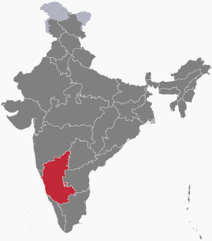
The map of India showing Karnataka
Location of Karnataka in India
Coordinates: 12°58′N 77°30′E / 12.97°N 77.50°E / 12.97; 77.50
CountryIndia
RegionSouth India
Before wasMysore State
Formation1 November 1956
Capital
and largest city
Bangalore
Largest metroBangalore
Districts31 (4 divisions)
Government
 • BodyGovernment of Karnataka
 • GovernorThawar Chand Gehlot
 • Chief ministerBasavaraj Bommai (BJP)
State LegislatureBicameral
 • CouncilKarnataka Legislative Council (75 seats)
 • AssemblyKarnataka Legislative Assembly (224 seats)
National ParliamentParliament of India
 • Rajya Sabha12 seats
 • Lok Sabha28 seats
High CourtKarnataka High Court
Area
 • Total
191,791 km2 (74,051 sq mi)
 • Rank6th
Dimensions
 • Length750 km (470 mi)
 • Width400 km (200 mi)
Elevation
460 m (1,510 ft)
Highest elevation1,925 m (6,316 ft)
Lowest elevation−1 m (−3 ft)
Population
 (2011)[4]
 • Total
Neutral increase 61,130,704
 • Rank8th
 • Density320/km2 (800/sq mi)
 • Urban
38.67%
 • Rural
61.33%
Demonym(s)Kannadiga (gender neutral)
Kannadati (feminine)
Language
 • OfficialKannada[5][6]
 • Official scriptKannada script
GDP
 • Total (2021–22)Increase20.5 trillion (US$250 billion)
 • Rank5th
 • Per capitaIncrease305,000 (US$3,700) (5th)
Time zoneUTC+05:30 (IST)
ISO 3166 codeIN-KA
Vehicle registrationKA
HDI (2022)Increase 0.706 High[8] (15th)
Literacy (2011)Increase 75.36%[9] (22nd)
Sex ratio (2011)973/1000 (6th)
Websitewww.karnataka.gov.in
Symbols of Karnataka
SongJaya Bharata Jananiya Tanujate, Jaya he Karnataka Maate
(Victory to You Mother Karnataka, Daughter of Mother India)[1]
Foundation dayKarnataka Formation Day
BirdIndian roller
FlowerLotus
MammalIndian elephant[10]
TreeSandalwood
State highway mark
State highway of Karnataka
KA SH1 - KA SH188
List of Indian state symbols
Karnataka
Etymology: Land of Kannadigas
Nickname: 
"IT Capital of India"
Motto
Satyameva Jayate (Truth alone triumphs)
Anthem: Jaya Bharata Jananiya Tanujate, Jaya he Karnataka Maate
(Victory to You Mother Karnataka, Daughter of Mother India)[1]
The map of India showing Karnataka
Location of Karnataka in India
Coordinates: 12°58′N 77°30′E / 12.97°N 77.50°E / 12.97; 77.50
Country India
RegionSouth India
Before wasMysore State
Formation1 November 1956
As province{{{formation_date5}}}
Capital
and largest city
Bangalore
Largest metroBangalore
Districts31 (4 divisions)
Government
 • BodyGovernment of Karnataka
 • GovernorThawar Chand Gehlot
 • Chief ministerBasavaraj Bommai (BJP)
State LegislatureBicameral
 • CouncilKarnataka Legislative Council (75 seats)
 • AssemblyKarnataka Legislative Assembly (224 seats)
National ParliamentParliament of India
 • Rajya Sabha12 seats
 • Lok Sabha28 seats
High CourtKarnataka High Court
Area
 • Total
191,791 km2 (74,051 sq mi)
 • Rank6th
Dimensions
 • Length750 km (470 mi)
 • Width400 km (200 mi)
Elevation
460 m (1,510 ft)
Highest elevation1,925 m (6,316 ft)
Lowest elevation−1 m (−3 ft)
Population
 (2011)[4]
 • Total
Neutral increase 61,130,704
 • Rank8th
 • Density320/km2 (800/sq mi)
 • Urban
38.67%
 • Rural
61.33%
Demonym(s)Kannadiga (gender neutral)
Kannadati (feminine)
Language
 • OfficialKannada[5][6]
 • Official scriptKannada script
GDP
 • Total (2021–22)Increase20.5 trillion (US$250 billion)
 • Rank5th
 • Per capitaIncrease305,000 (US$3,700) (5th)
Time zoneUTC+05:30 (IST)
ISO 3166 codeIN-KA
Vehicle registrationKA
HDI (2022)Increase 0.706 High[8] (15th)
Literacy (2011)Increase 75.36%[9] (22nd)
Sex ratio (2011)973/1000 (6th)
Websitewww.karnataka.gov.in
Symbols of Karnataka
SongJaya Bharata Jananiya Tanujate, Jaya he Karnataka Maate
(Victory to You Mother Karnataka, Daughter of Mother India)[1]
Foundation dayKarnataka Formation Day
BirdIndian roller
FlowerLotus
MammalIndian elephant[10]
TreeSandalwood
State highway mark
State highway of Karnataka
KA SH1 - KA SH188
List of Indian state symbols

References

[edit]
  1. ^ "Poem declared 'State song'". The Hindu. 11 January 2004. Archived from the original on 1 January 2016. Retrieved 22 May 2018.
  2. ^ "Protected Areas of India: State-wise break up of Wildlife Sanctuaries" (PDF). Wildlife Institute of India. Government of India. Archived (PDF) from the original on 24 October 2016. Retrieved 24 August 2016.
  3. ^ "Udupi-Chikmagalur: A constituency that's beset by problems". The Hindu. 2014-03-18. ISSN 0971-751X. Retrieved 2023-03-24.
  4. ^ "Figures at a glance" (PDF). 2011 Provisional census data. Ministry of Home Affairs, Government of India. Archived (PDF) from the original on 24 October 2011. Retrieved 17 September 2011.
  5. ^ 50th Report of the Commission for Linguistic Minorities in India (PDF). p. 123. Archived from the original (PDF) on 8 July 2016. {{cite book}}: Unknown parameter |agency= ignored (help)
  6. ^ "THE KARNATAKA OFFICIAL LANGUAGE ACT, 1963" (PDF). Archived (PDF) from the original on 15 January 2023. Retrieved 28 September 2022.
  7. ^ "Economic Survey of Karnataka 2021-22" (PDF). Reserve Bank of India. p. 6. Archived (PDF) from the original on 6 March 2022. Retrieved 11 February 2022.
  8. ^ "Sub-national HDI – Area Database". Global Data Lab. Institute for Management Research, Radboud University. Archived from the original on 23 September 2018. Retrieved 25 September 2018.
  9. ^ "Census 2011 (Final Data) – Demographic details, Literate Population (Total, Rural & Urban)" (PDF). planningcommission.gov.in. Planning Commission, Government of India. Archived from the original (PDF) on 27 January 2018. Retrieved 3 October 2018.
  10. ^ Huq, Iteshamul, ed. (2015). "Introduction" (PDF). A Handbook of Karnataka (Fifth ed.). Karnataka Gazetteer Department. p. 48. Archived (PDF) from the original on 23 May 2018. Retrieved 22 May 2018.