Tōyōchō Station
Appearance
(Redirected from Toyocho Station)
This article needs additional citations for verification. (May 2022) |
T14 Tōyōchō Station 東陽町駅 | |||||||||||||||
|---|---|---|---|---|---|---|---|---|---|---|---|---|---|---|---|
 Exit 5 in November 2018 | |||||||||||||||
| General information | |||||||||||||||
| Location | 2-1 Tōyō 4-chome Kōtō-ku Tokyo Japan | ||||||||||||||
| Operated by | |||||||||||||||
| Line(s) | T Tozai Line | ||||||||||||||
| Platforms | 2 side platforms | ||||||||||||||
| Tracks | 2 | ||||||||||||||
| Construction | |||||||||||||||
| Structure type | Underground | ||||||||||||||
| Other information | |||||||||||||||
| Station code | T-14 | ||||||||||||||
| History | |||||||||||||||
| Opened | 14 September 1967 | ||||||||||||||
| Services | |||||||||||||||
| |||||||||||||||
| |||||||||||||||
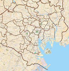
Tōyōchō Station (東陽町駅, Tōyōchō-eki) is a railway station in Kōtō, Tokyo, Japan. Its station number is T-14.
Lines
[edit]Station layout
[edit]The station consists of two side platforms serving two tracks.
Platforms
[edit]| 1 | T Tōzai Line | for Nishi-Funabashi JB Chuo-Sobu Line for Tsudanuma TR Toyo Rapid Railway Line for Tōyō-Katsutadai |
| 2 | T Tōzai Line | for Ōtemachi, Kudanshita, and Nakano JB Chuo-Sobu Line for Mitaka |
-
Station platforms, 2019
History
[edit]Tōyōchō Station opened on 14 September 1967.
The station facilities were inherited by Tokyo Metro after the privatization of the Teito Rapid Transit Authority (TRTA) in 2004.[1]
References
[edit]- ^ "「営団地下鉄」から「東京メトロ」へ" [From "Teito Rapid Transit Authority" to "Tokyo Metro"]. Tokyo Metro Online. 8 July 2006. Archived from the original on 16 May 2012. Retrieved 29 May 2022.
External links
[edit]Wikimedia Commons has media related to Tōyōchō Station.
- Tokyo Metro station information(in English)
35°40′11″N 139°49′03″E / 35.669626°N 139.817596°E


