Yzeure
Appearance
You can help expand this article with text translated from the corresponding article in French. (December 2008) Click [show] for important translation instructions.
|
Yzeure | |
|---|---|
Commune | |
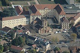
 Aerial view of the church and surroundings | |
| Coordinates: 46°34′01″N 3°21′19″E / 46.5669°N 3.3553°E | |
| Country | France |
| Region | Auvergne-Rhône-Alpes |
| Department | Allier |
| Arrondissement | Moulins |
| Canton | Yzeure |
| Intercommunality | CA Moulins Communauté |
| Government | |
| • Mayor (2020–2026) | Pascal Perrin[1] |
Area 1 | 43.24 km2 (16.70 sq mi) |
| Population (2021)[2] | 12,598 |
| • Density | 290/km2 (750/sq mi) |
| Demonym(s) | Yzeuriens, Yzeuriennes |
| Time zone | UTC+01:00 (CET) |
| • Summer (DST) | UTC+02:00 (CEST) |
| INSEE/Postal code | 03321 /03400 |
| Elevation | 217–278 m (712–912 ft) (avg. 239 m or 784 ft) |
| 1 French Land Register data, which excludes lakes, ponds, glaciers > 1 km2 (0.386 sq mi or 247 acres) and river estuaries. | |
Yzeure (French pronunciation: [izœʁ]) is a commune in the department of Allier in the Auvergne-Rhône-Alpes region of central France.
Location
[edit]The commune is located in the north of the Allier department.[3] It is the fifth most populated commune in the Allier department, according to the 2021 census.[4] It borders the commune of Moulins to the west and southwest.[5]
By roads, Nevers is 57 km to the north, Bourges is 100 km to the northwest, Clermont-Ferrand is 106 km to the south-southwest, Mâcon is 133 km to the east, Beaune is 145 km to the northeast, Auxerre is 157 km away, and Lyon is 188 km to the southeast.[6]
Population
[edit]
|
| ||||||||||||||||||||||||||||||||||||||||||||||||||||||||||||||||||||||||||||||||||||||||||||||||||||||||||||||||||
| |||||||||||||||||||||||||||||||||||||||||||||||||||||||||||||||||||||||||||||||||||||||||||||||||||||||||||||||||||
| Source: EHESS (1793–1999)[7] and INSEE[8] | |||||||||||||||||||||||||||||||||||||||||||||||||||||||||||||||||||||||||||||||||||||||||||||||||||||||||||||||||||
Twin towns – sister cities
[edit] Bendorf, Germany
 Gherla, Romania
 Kafountine, Senegal
See also
[edit]References
[edit]- ^ "Répertoire national des élus: les maires" (in French). data.gouv.fr, Plateforme ouverte des données publiques françaises. 13 September 2022.
- ^ "Populations légales 2021" (in French). The National Institute of Statistics and Economic Studies. 28 December 2023.
- ^ "Yzeure".
- ^ "Allier continues to lose inhabitants, discover how the population has evolved in your commune" (in French).
- ^ "Géoportail". www.geoportail.gouv.fr. Retrieved 22 November 2024.
- ^ "Yzeure · 03400, France". Yzeure · 03400, France. Retrieved 22 November 2024.
Road distances between two given points are calculated in the side panel (see the tab at the top left of the screen) – click on "Routes".
- ^ Des villages de Cassini aux communes d'aujourd'hui: Commune data sheet Yzeure, EHESS (in French).
- ^ Population en historique depuis 1968, INSEE
- ^ "Villes jumelles". ville-yzeure.com (in French). Yzeure. Retrieved 10 April 2021.
Wikimedia Commons has media related to Yzeure.


