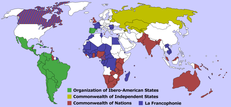
Archivo:Postempire Orgs Map.png
Apariencia

Tamaño de esta previsualización: 800 × 370 píxeles. Otras resoluciones: 320 × 148 píxeles · 640 × 296 píxeles · 1357 × 628 píxeles.
Ver la imagen en su resolución original (1357 × 628 píxeles; tamaño de archivo: 38 kB; tipo MIME: image/png)
Historial del archivo
Haz clic sobre una fecha y hora para ver el archivo tal como apareció en ese momento.
| Fecha y hora | Miniatura | Dimensiones | Usuario | Comentario | |
|---|---|---|---|---|---|
| actual | 20:28 4 ene 2023 |  | 1357 × 628 (38 kB) | Iktsokh | Correction of Armenia |
| 20:58 14 jun 2017 |  | 1357 × 628 (49 kB) | Mplaneta | Fix color of Crimea. | |
| 14:37 25 nov 2016 |  | 1357 × 628 (44 kB) | Maproom | Maldives from red to white, they left the Commonwealth in October 2016. | |
| 21:14 23 sep 2016 |  | 1357 × 628 (44 kB) | Maproom | Updated in accordance with request at https://en.wikipedia.org/wiki/Wikipedia:Graphics_Lab/Map_workshop#How_to_add_a_scale_to_a_map.3F : 1) Botswana is a CON member, so it should be shaded red. 2) Gambia left the Commonwealth in 2013, so it should now... | |
| 18:36 2 sep 2015 |  | 1357 × 628 (66 kB) | Nicolay Sidorov | + South Sudan. Fix borders of Russian, Egypt. Change CIS members (Georgia leaved in 2008, Ukraine is a non-member participant) | |
| 01:27 25 oct 2006 |  | 1357 × 628 (66 kB) | Hoshie | Updated to add Montenegro; under same license as orginial. | |
| 21:07 23 mar 2006 |  | 1357 × 628 (61 kB) | Maksim | La bildo estas kopiita de wikipedia:en. La originala priskribo estas: == Summary == Created by User:Aris Katsaris, by modifying Image:BlankMap-World-v2.png. International organizations that largely represent the states formed after the breakup o |
Usos del archivo
No hay páginas que enlacen a este archivo.
Uso global del archivo
Las wikis siguientes utilizan este archivo:


