法什塔:修订间差异
外观
删除的内容 添加的内容
Georgialwtowen(留言 | 贡献) ←建立内容为“{{Infobox settlement <!--See Template:Infobox settlement for additional fields that may be available--> <!--See the Table at Infobox settlement for...”的新页面 |
BigBullfrog(留言 | 贡献) 无编辑摘要 |
||
| (未显示9个用户的13个中间版本) | |||
| 第1行: | 第1行: | ||
{{unreferenced|time=2016-02-23T01:48:40+00:00}} |
|||
{{Infobox settlement |
{{Infobox settlement |
||
<!--See Template:Infobox settlement for additional fields that may be available--> |
<!--See Template:Infobox settlement for additional fields that may be available--> |
||
<!--See the Table at Infobox settlement for all fields and descriptions of usage--> |
<!--See the Table at Infobox settlement for all fields and descriptions of usage--> |
||
<!-- Basic info ----------------> |
<!-- Basic info ----------------> |
||
|name = |
|name = 法什塔 |
||
|official_name = |
|official_name = |
||
|other_name = |
|other_name = |
||
|native_name = |
|native_name = Farsta |
||
|nickname = |
|nickname = |
||
|settlement_type = |
|settlement_type = 斯德哥爾摩的區 |
||
|motto = |
|motto = |
||
<!-- images and maps -----------> |
<!-- images and maps -----------> |
||
|image_skyline = Sthlm suburb.jpg |
|image_skyline = Sthlm suburb.jpg |
||
|imagesize = 300px |
|imagesize = 300px |
||
|image_caption = |
|image_caption = |
||
|image_flag = |
|image_flag = |
||
|flag_size = |
|flag_size = |
||
| 第25行: | 第26行: | ||
|image_map = Stockholm boroughs 2007 Farsta.svg |
|image_map = Stockholm boroughs 2007 Farsta.svg |
||
|mapsize = |
|mapsize = |
||
|map_caption = |
|map_caption = 法什塔(黄色)在斯德哥尔摩的位置 |
||
| |
|pushpin_map = Sweden |
||
| |
|pushpin_label_position = <!-- the position of the pushpin label: left, right, top, bottom, none --> |
||
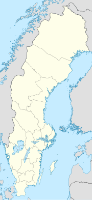
|pushpin_map_caption = 在瑞典的位置 |
|||
|pushpin_map_caption1 = Location of Farsta within Sweden |
|||
| |
|pushpin_mapsize = 180px |
||
| |
|coordinates = {{coord|59|14|25|N|18|05|50|E|region:SE|display=inline,title}} |
||
|latd=59 |latm=14 |lats=25 |latNS=N |
|||
|longd=18 |longm=05 |longs=50 |longEW=E |
|||
<!-- Location ------------------> |
<!-- Location ------------------> |
||
| subdivision_type = [[世界政區索引|国家]] |
|||
|coordinates_region = SE |
|||
| |
| subdivision_name = {{SWE}} |
||
| ⚫ | |||
|subdivision_name = [[瑞典]] |
|||
| ⚫ | |||
| ⚫ | |||
| ⚫ | |||
| ⚫ | |||
| ⚫ | |||
| ⚫ | |||
| ⚫ | |||
<!-- Smaller parts (e.g. boroughs of a city) and seat of government --> |
<!-- Smaller parts (e.g. boroughs of a city) and seat of government --> |
||
|seat_type = |
|seat_type = |
||
| 第52行: | 第50行: | ||
<!-- Politics -----------------> |
<!-- Politics -----------------> |
||
|government_footnotes = |
|government_footnotes = |
||
|government_type = |
|government_type = |
||
|leader_title = |
|leader_title = |
||
|leader_name = |
|leader_name = |
||
|established_title = |
|established_title = 成立 |
||
|established_date = |
|established_date = 1997年 |
||
<!-- Area ---------------------> |
<!-- Area ---------------------> |
||
|total_type = |
|total_type = |
||
| 第75行: | 第73行: | ||
|elevation_min_ft = |
|elevation_min_ft = |
||
<!-- Population -----------------------> |
<!-- Population -----------------------> |
||
|population_as_of = 2014 |
|population_as_of = 2014年 |
||
|population_footnotes = |
|population_footnotes = |
||
|population_note = |
|population_note = |
||
|population_total = |
|population_total = 55,300 |
||
|population_density_km2 = auto |
|population_density_km2 = auto |
||
<!-- General information ---------------> |
<!-- General information ---------------> |
||
|timezone = [[ |
|timezone = [[欧洲中部时间|CET]] |
||
|utc_offset = +1 |
|utc_offset = +1 |
||
|timezone_DST = [[ |
|timezone_DST = [[欧洲中部夏令时间|CEST]] |
||
|utc_offset_DST = +2 |
|utc_offset_DST = +2 |
||
<!-- Area/postal codes & others --------> |
<!-- Area/postal codes & others --------> |
||
|postal_code_type = [[ |
|postal_code_type = [[瑞典郵區編號|邮政编码]] |
||
|postal_code = 122 --, 123 --, 128 -- |
|postal_code = 122 --, 123 --, 128 -- |
||
|area_code_type |
|area_code_type = 电话区号 |
||
|area_code = 08 |
|area_code = 08 |
||
|website = [http://www.stockholm.se/OmStockholm/Forvaltningar-och-bolag/Stadsdelsforvaltningar/Farsta/ Stockholm.se] |
|website = [http://www.stockholm.se/OmStockholm/Forvaltningar-och-bolag/Stadsdelsforvaltningar/Farsta/ Stockholm.se] |
||
|footnotes = |
|footnotes = |
||
}} |
}} |
||
'''法 |
'''法什塔'''({{lang-sv|Farsta}})是[[瑞典]]首都[[斯德哥爾摩]]的一個区,位於斯德哥爾摩南部。2014年人口55,300人,面積15.40 km²。法爾斯塔下由十個分區構成。 |
||
{{斯德哥尔摩的区}} |
|||
[[Category:斯德哥尔摩的区|F]] |
|||
2022年7月28日 (四) 22:31的最新版本
此條目没有列出任何参考或来源。 (2016年2月23日) |
| 法什塔 Farsta | |
|---|---|
| 斯德哥爾摩的區 | |
 | |
 法什塔(黄色)在斯德哥尔摩的位置 | |
| 坐标:59°14′25″N 18°05′50″E / 59.24028°N 18.09722°E | |
| 国家 | |
| 城市 | 斯德哥尔摩 |
| 区域 | 南地 |
| 成立 | 1997年 |
| 面积 | 15.40 平方公里(5.95 平方英里) |
| 人口(2014年) | 55,300人 |
| • 密度 | 3,591人/平方公里(9,300人/平方英里) |
| 时区 | CET(UTC+1) |
| • 夏时制 | CEST(UTC+2) |
| 邮政编码 | 122 --, 123 --, 128 -- |
| 电话区号 | 08 |
| 網站 | Stockholm.se |
法什塔(瑞典語:Farsta)是瑞典首都斯德哥爾摩的一個区,位於斯德哥爾摩南部。2014年人口55,300人,面積15.40 km²。法爾斯塔下由十個分區構成。

