萨拉昆达:修订间差异
外观
删除的内容 添加的内容
小 機器人 新增: nl:Serekunda |
CommonsDelinker(留言 | 贡献) Bot:以Serekunda_Market_Mosque_-_2010.jpg代替BundungMosque.jpg(CommonsDelinker的要求:File renamed: Criterion 3 (obvious error) · This appears to be |
||
| (未显示18个用户的29个中间版本) | |||
| 第1行: | 第1行: | ||
{{Infobox settlement |
|||
<!--See the Table at Infobox Settlement for all fields and descriptions of usage--> |
|||
<!-- Basic info ----------------> |
|||
|name =薩拉昆達 |
|||
|official_name = Serekunda |
|||
|other_name = |
|||
|native_name = سيريكوندا |
|||
|nickname = |
|||
|settlement_type = 城市 |
|||
|motto = |
|||
<!-- images and maps -----------> |
|||
|image_skyline = Gambia-kairabaav.JPG |
|||
|imagesize = 300px |
|||
|image_caption = |
|||
|image_flag = |
|||
|seal_size = |
|||
|image_shield = |
|||
|shield_size = |
|||
|image_blank_emblem = |
|||
|blank_emblem_type = |
|||
|blank_emblem_size = |
|||
|image_map = |
|||
|mapsize = |
|||
|map_caption = |
|||
|image_map1 = |
|||
|mapsize1 = |
|||
|map_caption1 = |
|||
|image_dot_map = |
|||
|dot_mapsize = |
|||
|dot_map_caption = |
|||
|dot_x = |dot_y = |
|||
|pushpin_map = Gambia <!-- the name of a location map as per http://en.wikipedia.org/wiki/Template:Location_map --> |
|||
|pushpin_label_position =bottom |
|||
|pushpin_mapsize =300 |
|||
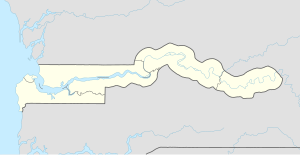
|pushpin_map_caption =薩拉昆達在甘比亞的位置<!-- Location ------------------> |
|||
|coordinates_region = GM |
|||
|subdivision_type = 國家 |
|||
|subdivision_name = {{Flag|Gambia}} |
|||
|subdivision_type1 = {{le|甘比亞的一級行政區|Divisions of the Gambia|一級行政區}} |
|||
|subdivision_name1 = [[班珠爾市]] |
|||
|subdivision_type2 = {{le|甘比亞的二級行政區|Districts of the Gambia|二級行政區劃}} |
|||
|subdivision_name2 = |
|||
<!-- Politics -----------------> |
|||
|government_footnotes = |
|||
|government_type = |
|||
|leader_title = |
|||
|leader_name = |
|||
|leader_title1 = <!-- for places with, say, both a mayor and a city manager --> |
|||
|leader_name1 = |
|||
|leader_title2 = |
|||
|leader_name2 = |
|||
|leader_title3 = |
|||
|leader_name3 = |
|||
|leader_title4 = |
|||
|leader_name4 = |
|||
|established_title = <!-- Settled --> |
|||
|established_date = |
|||
|established_title2 = <!-- Incorporated (town) --> |
|||
|established_date2 = |
|||
|established_title3 = <!-- Incorporated (city) --> |
|||
|established_date3 = |
|||
<!-- Area ---------------------> |
|||
|area_magnitude = |
|||
|unit_pref =Imperial <!--Enter: Imperial, if Imperial (metric) is desired--> |
|||
|area_footnotes = |
|||
|area_total_km2 = |
|||
|area_land_km2 = <!--See table @ Template:Infobox Settlement for details on automatic unit conversion--> |
|||
|area_water_km2 = |
|||
|area_total_sq_mi = |
|||
|area_land_sq_mi = |
|||
|area_water_sq_mi = |
|||
|area_water_percent = |
|||
|area_urban_km2 = |
|||
|area_urban_sq_mi = |
|||
|area_metro_km2 = |
|||
|area_metro_sq_mi = |
|||
|area_blank1_title = |
|||
|area_blank1_km2 = |
|||
|area_blank1_sq_mi = |
|||
<!-- Population -----------------------> |
|||
|population_as_of = |
|||
|population_footnotes = <ref>{{cite web|url=http://www.accessgambia.com/information/serrekunda-town.html|title=Gambia town information|accessdate=2008-01-15|archive-date=2010-01-15|archive-url=https://web.archive.org/web/20100115201057/http://accessgambia.com/information/serrekunda-town.html|dead-url=no}}</ref> |
|||
|population_note = |
|||
|population_total = ~337,000人 |
|||
|population_density_km2 = |
|||
|population_density_sq_mi = |
|||
|population_metro = |
|||
|population_density_metro_km2 = |
|||
|population_density_metro_sq_mi = |
|||
|population_urban = |
|||
|population_density_urban_km2 = |
|||
|population_density_urban_sq_mi = |
|||
|population_blank1_title =Ethnicities |
|||
|population_blank1 = |
|||
|population_blank2_title =Religions |
|||
|population_blank2 = |
|||
|population_density_blank1_km2 = |
|||
|population_density_blank1_sq_mi = |
|||
<!-- General information ---------------> |
|||
|timezone = |
|||
|utc_offset = |
|||
|timezone_DST = |
|||
|utc_offset_DST = |
|||
|elevation_footnotes = <!--for references: use <ref> tags--> |
|||
|elevation_m = |
|||
|elevation_ft = <!-- accord. to Google Earth--> |
|||
<!-- Area/postal codes & others --------> |
|||
|postal_code_type = <!-- enter ZIP code, Postcode, Post code, Postal code... --> |
|||
|postal_code = |
|||
|area_code = |
|||
|blank_name = |
|||
|blank_info = |
|||
|blank1_name = |
|||
|blank1_info = |
|||
|website = |
|||
|footnotes = |
|||
}} |
|||
[[File:GM-Serrekunda.png|right|255px|萨拉昆达在冈比亚的位置]] |
[[File:GM-Serrekunda.png|right|255px|萨拉昆达在冈比亚的位置]] |
||
'''萨拉昆达'''({{lang-ar|سيريكوندا}})是[[冈比亚]]的最大城市<ref>{{cite web|url=http://www.lonelyplanet.com/the-gambia/serekunda-and-the-atlantic-coast|title=Introducing Serekunda & the Atlantic Coast|publisher=Lonely Planet|accessdate=29 May 2014|archive-date=2018-06-25|archive-url=https://web.archive.org/web/20180625023130/https://www.lonelyplanet.com/the-gambia/serekunda-and-the-atlantic-coast|dead-url=no}}</ref>。 |
|||
{{Coor title dm|13|26||N|16|40||W|type:city}} |
|||
'''萨拉昆达'''([[英语]]:'''{{lang|en|Serrekunda}}'''或'''{{lang|en|Serekunda}}''')是[[冈比亚]]的最大城市,位于首都[[班珠尔]]之西南方,[[2006年]]估计人口335,733。 |
|||
薩拉昆達瀕臨大西洋,位于首都[[班珠尔市]]之西南方{{convert|13|km|0|abbr=on}}處<ref name=accessgambia>{{cite web |url=http://www.accessgambia.com/information/serrekunda-town.html |title=Serrekunda Town, Gambia |publisher=Access Gambia |accessdate=2015-07-15 |archive-date=2010-01-15 |archive-url=https://web.archive.org/web/20100115201057/http://accessgambia.com/information/serrekunda-town.html |dead-url=no }}</ref>。該市是由9個聚落集結為較大的都會區。 |
|||
==友好城市== |
|||
薩拉昆達的原文指「謝列爾人之家」,也是紀念該市的開拓者{{le|赛尔·乔贝|Sayerr Jobe}}<ref name=accessgambia/>。 |
|||
== 友好城市 == |
|||
*{{flagicon|US}} [[美国]][[田纳西州]][[孟菲斯 (田纳西州)|孟菲斯]] |
*{{flagicon|US}} [[美国]][[田纳西州]][[孟菲斯 (田纳西州)|孟菲斯]] |
||
== |
==附加圖像== |
||
<gallery> |
|||
*[http://www.accessgambia.com/information/serrekunda-town.html 萨拉昆达酒店资料、照片和地图] |
|||
File:Gambia 001 from KG.jpg| |
|||
File:Gambia Serekunda world66-2.jpg| |
|||
File:Gambia-mosque.JPG| |
|||
File:Serekunda Market Mosque - 2010.jpg|Bundung公路边清真寺 |
|||
</gallery> |
|||
==參考文獻== |
|||
{{africa-geo-stub}} |
|||
{{reflist}} |
|||
== 外部链接 == |
|||
{{DEFAULTSORT:Serekunda}} |
|||
*[http://www.accessgambia.com/information/serrekunda-town.html 萨拉昆达酒店资料、照片和地图] {{Wayback|url=http://www.accessgambia.com/information/serrekunda-town.html |date=20100115201057 }} |
|||
{{Coord|13|26|N|16|40|W|type:city|display=title}} |
|||
{{Commons category|Serekunda}} |
|||
{{Wikivoyagelang|en|Serekunda}} |
|||
{{gambia-geo-stub}} |
|||
{{normdaten}} |
|||
[[Category:冈比亚城市]] |
[[Category:冈比亚城市]] |
||
[[af:Serrekunda]] |
|||
[[ar:سيريكوندا]] |
|||
[[ca:Serekunda]] |
|||
[[cs:Serekunda]] |
|||
[[da:Serekunda]] |
|||
[[de:Serekunda]] |
|||
[[en:Serekunda]] |
|||
[[es:Serekunda]] |
|||
[[et:Serekunda]] |
|||
[[fi:Serekunda]] |
|||
[[fr:Serrekunda]] |
|||
[[ja:セレクンダ]] |
|||
[[lv:Serekunda]] |
|||
[[nl:Serekunda]] |
|||
[[pl:Serrekunda]] |
|||
[[pt:Serekunda]] |
|||
[[ro:Serekunda]] |
|||
[[ru:Серекунда]] |
|||
[[sk:Serekunda]] |
|||
[[sv:Serrekunda]] |
|||
[[vi:Serekunda]] |
|||
2024年8月30日 (五) 11:00的最新版本
| 薩拉昆達 سيريكوندا | |
|---|---|
| 城市 | |
| Serekunda | |
 | |
| 坐标:13°26′42″N 16°40′30″W / 13.445°N 16.675°W | |
| 國家 | |
| 一級行政區 | 班珠爾市 |
| 人口[1] | |
| • 總計 | ~337,000人 |

萨拉昆达(阿拉伯语:سيريكوندا)是冈比亚的最大城市[2]。
薩拉昆達瀕臨大西洋,位于首都班珠尔市之西南方13 km(8 mi)處[3]。該市是由9個聚落集結為較大的都會區。
薩拉昆達的原文指「謝列爾人之家」,也是紀念該市的開拓者赛尔·乔贝[3]。
友好城市
[编辑]附加圖像
[编辑]-
Bundung公路边清真寺
參考文獻
[编辑]- ^ Gambia town information. [2008-01-15]. (原始内容存档于2010-01-15).
- ^ Introducing Serekunda & the Atlantic Coast. Lonely Planet. [29 May 2014]. (原始内容存档于2018-06-25).
- ^ 3.0 3.1 Serrekunda Town, Gambia. Access Gambia. [2015-07-15]. (原始内容存档于2010-01-15).
外部链接
[编辑]13°26′N 16°40′W / 13.433°N 16.667°W
| 这是一篇與岡比亞地理相關的小作品。您可以通过编辑或修订扩充其内容。 |


