門弗羅 (密蘇里州):修订间差异
外观
删除的内容 添加的内容
小 // Edit via Wikiplus |
补救1个来源,并将0个来源标记为失效。) #IABot (v2.0.9.5 |
||
| 第52行: | 第52行: | ||
== 歷史 == |
== 歷史 == |
||
門弗羅的郵局於1904年設立,其後於1996年停運。<ref>{{cite web | url=https://www.postalhistory.com/postoffices.asp?task=display&state=MO&county=Perry&searchtext=&pagenum=2 | title=Perry County | publisher=Jim Forte Postal History | accessdate=2024-06-05 }}</ref> |
門弗羅的郵局於1904年設立,其後於1996年停運。<ref>{{cite web | url=https://www.postalhistory.com/postoffices.asp?task=display&state=MO&county=Perry&searchtext=&pagenum=2 | title=Perry County | publisher=Jim Forte Postal History | accessdate=2024-06-05 | archive-date=2024-06-05 | archive-url=https://web.archive.org/web/20240605035254/https://www.postalhistory.com/postoffices.asp?task=display&state=MO&county=Perry&searchtext=&pagenum=2 | dead-url=no }}</ref> |
||
== 地理 == |
== 地理 == |
||
2024年12月19日 (四) 21:45的最新版本
| 門弗羅 Menfro | |
|---|---|
| 非建制地區 | |
 | |
| 坐标:37°46′37″N 89°43′24″W / 37.77694°N 89.72333°W | |
| 國家 | 美国 |
| 州份 | 密蘇里州 |
| 縣 | 佩里縣 |
| 海拔 | 109 公尺(358 英尺) |
| 时区 | CST(UTC-6) |
| • 夏时制 | CDT(UTC-5) |
| 郵區編號 | 63775 |
| 電話區號 | 573 |
| GNIS ID | 722232[1] |
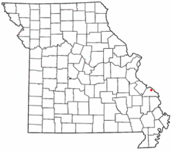
門弗羅(英語:Menfro)是位於美國密蘇里州佩里縣的非建制地區。
歷史
[编辑]門弗羅的郵局於1904年設立,其後於1996年停運。[2]
地理
[编辑]門弗羅所處的海拔為高於海平面109米(即358英呎),而該地所採用的時區為UTC-6,即北美中部時區(CST)。同時該地設有夏令時間,為UTC-6調快一小時,即UTC-5(CDT)。
參考文獻
[编辑]- ^ Menfro. Geographic Names Information System. United States Geological Survey.
- ^ Perry County. Jim Forte Postal History. [2024-06-05]. (原始内容存档于2024-06-05).
| 这是一篇密蘇里州的地理小作品。您可以通过编辑或修订扩充其内容。 |


