英国世界遗产列表:修订间差异
外观
删除的内容 添加的内容
小 Link Style Date Using WP:AWB |
Maizibusi1988(留言 | 贡献) |
||
| 第53行: | 第53行: | ||
| 由罗马人作为矿泉城而建立,同时也是中世纪时重要羊毛业中心和[[18世纪]]的一座矿泉城,巴斯城拥有形形色色的历史。该城因为罗马人留下的遗迹和[[帕拉第奥式建筑]]而被保护下来。<ref name="Bath"/> |
| 由罗马人作为矿泉城而建立,同时也是中世纪时重要羊毛业中心和[[18世纪]]的一座矿泉城,巴斯城拥有形形色色的历史。该城因为罗马人留下的遗迹和[[帕拉第奥式建筑]]而被保护下来。<ref name="Bath"/> |
||
|- |
|- |
||
| [[康沃尔和西德文矿业景观]] |
| [[康沃爾和西德文礦區景觀|康沃尔和西德文矿业景观]] |
||
| [[File:Crowns peh.jpg|250px]] |
| [[File:Crowns peh.jpg|250px]] |
||
| {{sort|England, Cornwall|英格兰[[康沃尔郡]]和[[德文郡]]}}<br />{{coord|50.13|-5.38|name=Cornwall and West Devon Mining Landscape}}<ref name="mining landscape">{{citation |url=http://whc.unesco.org/en/list/488 |title=Cornwall and West Devon Mining Landscape |publisher=UNESCO |accessdate=2009-08-12}}</ref> |
| {{sort|England, Cornwall|英格兰[[康沃尔郡]]和[[德文郡]]}}<br />{{coord|50.13|-5.38|name=Cornwall and West Devon Mining Landscape}}<ref name="mining landscape">{{citation |url=http://whc.unesco.org/en/list/488 |title=Cornwall and West Devon Mining Landscape |publisher=UNESCO |accessdate=2009-08-12}}</ref> |
||
2016年1月10日 (日) 03:42的版本

英国世界遗产列表是列出英国獲聯合國教科文組織提名為世界遗产的列表[1]。目前英国共有28处世界遗产,其中17個在英格蘭、4個在蘇格蘭、3個在威爾士、1個在北愛爾蘭,海外領土的百慕達、皮特凱恩群島、聖赫勒拿分別各有1個[2]。
1986年,圭內斯郡愛德華國王的城堡和城牆、达勒姆城堡和座堂、巨人堤道及堤道海岸、铁桥峡谷、圣基尔达、巨石阵、埃夫伯里和相关地点群、包括方廷斯隐修院废墟的斯塔德利王家公园同时列入世界遗产,开启了英国世界遗产的先河。随后又有多处世界遗产列入,最近被列入的是2009年的庞特基西斯特输水道及运河。
地點
教科文組織清單包含十七個指定的遺產在英格兰(其中罗马帝国的边界与德国共有),四個在蘇格蘭、三個在威爾士 和 北愛爾蘭, 另外有三個在英國的海外領土百慕達、皮特凱恩群島 和 聖海倫娜。以下的地圖顯示了所有當前英國的世界文化遺產。

| 名称 | 图片 | 位置 | 年代 | 编号 | 描述 |
|---|---|---|---|---|---|
| 布莱纳文工业景观 | 
|
威尔士布莱纳文 51°47′N 3°05′W / 51.78°N 3.08°W[3] |
19世纪[3] | 984; 2000; iii, iv[3] |
在19世纪,威尔士是世界上最大的钢铁与煤炭生产者。在这些原料生产相关的工业过程所创造的景观中,布莱纳文极具代表性。该地点包括了采石场、公共建筑群、工人宿舍以及一条铁路[3] |
| 布萊尼姆宮 | 
|
英格兰牛津郡伍德斯托克 51°50′28″N 1°21′40″W / 51.841°N 1.361°W[4] |
1705–1722[4] | 425; 1987; ii, iv[4] |
布萊尼姆宮,第一代马尔博罗公爵约翰·丘吉尔的英国乡村别墅,由建筑师约翰·凡布鲁及尼古拉斯·霍克斯穆尔设计。内附的庭院由兰斯洛特·布朗装点。该宫殿为庆祝对法国的战争之胜利而建,并对英国罗曼式建筑(English Romantic Architecture)成为独立于法式古典建筑(French Classical Architecture)的种类有重要意义。[4] |
| 坎特伯雷座堂、圣奥斯定隐修院和圣马丁教堂 | 
|
英格兰肯特郡坎特伯雷 51°17′N 1°05′E / 51.28°N 1.08°E[5] |
11世纪[5] | 496; 1988; i, ii, vi[5] |
圣马丁教堂是英格兰最古老的教堂。该教堂与圣奥斯定隐修院在基督教引入盎格鲁-萨克逊的早期被兴建。而坎特伯雷座堂则呈现出罗曼式建筑及哥特式建筑风格,并且它是英国圣公会首席主教坎特伯雷大主教的主教座堂。[5][6][7] |
| 圭內斯郡愛德華國王的城堡和城牆 | 
|
威尔士康威、安格尔西岛与圭内斯 53°08′20″N 4°16′34″W / 53.139°N 4.276°W[8] |
13–14世纪[8] | 374; 1986; i, iii, iv[8] |
在爱德华一世 (英格兰)统治时期,一系列城堡为统治当地人,并建立英格兰人的聚居地而建立在威尔士。世界遗产名录中包括许多城堡,如Beaumaris, Caernarfon, Conwy, 和Harlech。爱德华一世的城堡被军事历史家认为是军事建筑的顶尖。[8][9] |
| 巴斯城 | 
|
英格兰萨默塞特郡巴斯 51°22′48″N 2°21′36″W / 51.380°N 2.360°W[10] |
1st–19th century[10] | 428; 1987; i, ii, iv[10] |
由罗马人作为矿泉城而建立,同时也是中世纪时重要羊毛业中心和18世纪的一座矿泉城,巴斯城拥有形形色色的历史。该城因为罗马人留下的遗迹和帕拉第奥式建筑而被保护下来。[10] |
| 康沃尔和西德文矿业景观 | 
|
英格兰康沃尔郡和德文郡 50°08′N 5°23′W / 50.13°N 5.38°W[11] |
18-19世纪[11] | 1,215; 2006; ii, iii, iv[11] |
康沃尔和西德文的锡矿和铜矿的开采在18和19世纪激增,在巅峰时,该地区生产了全世界三分之二的铜。康沃尔和西德文发展的深井开采技术与科技已被全世界使用。[11] |
| 德文特河流域工场群 | 
|
英格兰德比郡Derwent Valley 53°01′12″N 1°29′56″W / 53.020°N 1.499°W[12] |
18-19世纪[12] | 1,030; 2001; ii, iv[12] |
德文特河谷是工厂生产制的发祥地,在此发生了一系列的发明创新,包括机器的发展——如水力纺纱机,和工人宿舍的进步——如克罗姆福德,在工业革命中相当重要。德文特河谷的模式此后还影响到了欧陆和北美。[13] |
| 多塞特和东德文海岸 | 
|
英格兰多塞特郡和德文郡 50°42′N 2°59′W / 50.70°N 2.98°W[14] |
n/a | 1029; 2001; viii[14] |
组成多塞特郡和德文郡海岸的悬崖是一处重要的化石景观,并且向世人提供了已持续1.85亿年该处陆生生物及海洋生物的记录。[14] |
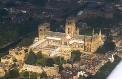
| 达勒姆城堡和座堂 | 
|
英格兰达勒姆郡达勒姆 54°46′26″N 1°34′30″W / 54.774°N 1.575°W[15] |
11-12世纪[15] | 370; 1986; ii, iv, vi[15] |
达勒姆座堂是英格兰“最大及最精美”的罗曼式建筑的范例且该座堂屋顶的拱形结构是哥特式建筑诞生的前奏之一。座堂存放着St Cuthbert 和 比德的圣骨。而罗曼城堡则是Durham prince-bishops的住所。[15] |
| 罗马帝国的边界(与德国共有)哈德良長城,安東尼長城 | 
|
英格兰北部与苏格兰南部 54°59′N 2°36′W / 54.99°N 2.60°W[16] |
2世纪[16] | 430; 1987 (modified in 2005 and 2008); ii, iii, iv[16] |
建造於西元122年的哈德良長城和142年的安東尼長城是羅馬用來抵禦野蠻人的防禦工事。[16]過去只有單獨將哈德良長城列入世界遺產,之後則納入所有羅馬在第一、第二世紀的前線遺蹟。範圍從蘇格蘭的安東尼長城到東歐的圖拉真長城。[17] |
| 巨人堤道及堤道海岸 | 
|
北爱尔兰安特里姆郡 55°14′24″N 6°30′40″W / 55.240°N 6.511°W[18] |
60–50百万年前[18] | 369; 1986; vii, viii[18] |
巨人堤道由40000支伸出海面的玄武岩石柱组成。该景观由第三纪的火山活动构成。[18] |
| 戈夫島和伊纳克塞瑟布尔岛 | 
|
圣赫勒拿、阿森松与特里斯坦达库尼亚 40°19′05″S 9°56′07″W / 40.3181°S 9.9353°W[19] |
n/a | 740; 1995 (modified in 2004); vii, x[19] |
戈夫島和伊纳克塞瑟布尔岛一直维持着几乎不被人类所改变的生态环境。岛上生存着许多土著种动植物。[19] |
| 新石器时代奥克尼的中心 | 
|
苏格兰奥克尼群岛 58°59′46″N 3°11′17″W / 58.996°N 3.188°W[20] |
3rd millennium BC[20] | 514; 1999; i, ii, iii, iv[20] |
一系列以居住消遣到典礼仪式为目的而建造的新石器时代遗址。包括斯卡拉布雷、梅肖韦古墓、斯丹尼斯立石和布罗德盖石圈.[20] |
| 亨德森島 | 
|
皮特凯恩群岛亨德森岛 24°21′S 128°19′W / 24.35°S 128.31°W[21] |
n/a | 487; 1988; vii, x[21] |
该岛屿是位于南太平洋的珊瑚礁,岛上的生态环境几乎未被人类改变,并且其被隔离的环境阐述了生物进化的动力。(and its isolation illustrates the dynamics of evolution.)岛内共有10种土著植物和4种土著动物。[21] |
| 百慕大圣乔治历史城镇及相关防御工事群 | 
|
百慕大圣乔治斯 51°22′51″N 2°21′37″W / 51.3809°N 2.3603°W[22] |
17–20世纪[22] | 983; 2000; iv[22] |
建立于1612年,圣乔治斯是英国在新世界建立的最早的城镇,也是17世纪殖民列强城市规划的一个实例。百慕大圣乔治历史城镇及相关防御工事群展示了自17世纪至20世纪发展的防御技术。[22] |
| 铁桥峡谷 | 
|
英格兰什罗普郡Ironbridge 52°37′34″N 2°29′10″W / 52.626°N 2.486°W[23] |
18世纪[23] | 371; 1986; i, ii, iv, vi[23] |
铁桥峡谷包括自从工业革命时建造的矿山,工厂,工人住宅区和基础交通设施。当地焦炭资源的开发促进了工业革命的开展。该铁桥是世界第一座使用钢铁建造的桥,并在建筑学上与技术上影响深远。[23] |
| 利物浦-海商城市 | 
|
英格兰默西賽德郡利物浦 53°24′N 2°59′W / 53.40°N 2.99°W[24] |
18-19世纪[24] | 1,150; 2004; ii, iii, iv[24] |
在18世纪和19世纪,利物浦是世界上最大的港口之一。它的全球经济连接有助于维持大英帝国,而且它也是黑奴贸易 (跨大西洋)的一个主要港口,直到1807年英国禁止贩奴贸易,它还是北美移民的一个出发点。这些码头是码头建筑和管理创新的一个展现(The docks were the site of innovations in construction and dock management)。[24] |
| 海事格林尼治 | 
|
英格兰大伦敦地区伦敦格林威治 51°28′45″N 0°00′00″E / 51.4791°N 0°E[25] |
17-18世纪[25] | 795; 1997; i, ii, iv, vi[25] |
As well as the presence of the first example of Palladian architecture in England, and works by Christopher Wren and Inigo Jones, the area is significant for the Royal Observatory where the understanding of astronomy and navigation were developed.[25] |
| 新拉纳克 | 
|
苏格兰南拉纳克郡新拉纳克 55°40′N 3°47′W / 55.66°N 3.78°W[26] |
19世纪[26] | 429; 2001; ii, iv, vi[26] |
Prompted by Richard Arkwright's factory system developed in the Derwent Valley, the community of New Lanark was created to provide housing for workers at the mills. Philanthropist Robert Owen bought the site and turned it into a model community, providing public facilities, education, and supporting factory reform.[26] |
| 愛丁堡的老城和新城 | 
|
苏格兰爱丁堡 55°56′49″N 3°11′28″W / 55.947°N 3.191°W[27] |
11–19世纪[27] | 728; 1995; ii, iv[27] |
爱丁堡老城于中世纪被建立,而新城发展于1767-1890年间。新老城的对比展现了中世纪与近代聚落布局的差异(It contrasts the layout of settlements in the medieval and modern periods)。新城的布局与结构由杰出建筑师如威廉·钱伯斯及威廉·普莱菲设计,并影响了18到19世纪的欧洲城市设计。[27] |
| 庞特基西斯特输水道及运河 | 
|
威尔士Trevor, Wrexham与英格兰什罗普郡 52°58′12″N 3°05′13″W / 52.970°N 3.087°W[28] |
1795–1805[28] | 1,303; 2009; i, ii, iv[28] |
The aqueduct was built to carry the Ellesmere Canal over the Dee Valley. Completed during the Industrial Revolution and designed by Thomas Telford, the aqueduct made innovative use of cast and wrought iron, influencing civil engineering across the world.[28][29] |
| 邱的王家植物园 | 
|
英格兰大伦敦地区Kew 51°28′26″N 0°17′42″W / 51.474°N 0.295°W[30] |
18–20世纪[30] | 1,084; 2003; ii, iii, iv[30] |
极具影响力的邱园由Charles Bridgeman, 威廉·肯特, Capability Brown,和William Chambers设计并于1759年建造.邱园被用来学习植物学、生态学以及对此两种学科更深层次的理解。[30] |
| 圣基尔达 | 
|
苏格兰圣基尔达岛 57°48′58″N 8°34′59″W / 57.816°N 8.583°W[31] |
n/a | 387; 1987 (modified in 2005 and 2008); ii, iii, iv[31] |
Although inhabited for over 2,000 years, the isolated archipelago of St Kilda has had no permanent residents since 1930. The islands' human heritage includes various unique architectural features from the historic and prehistoric periods. St Kilda is also a breeding ground for many important seabird species including the world's largest colony of gannets and up to 136,000 pairs of puffins.[31][32] |
| 索尔泰尔 | 
|
英格兰西约克郡布拉德福德市索尔泰尔 53°50′13″N 1°47′24″W / 53.837°N 1.790°W[33] |
1853[33] | 1,028; 2001; ii, iv[33] |
Saltaire was founded by mill-owner Titus Salt as a model village for his workers. The site, which includes the Salts Mill, featured public buildings for the inhabitants and was an example of 19th century paternalism.[33] |
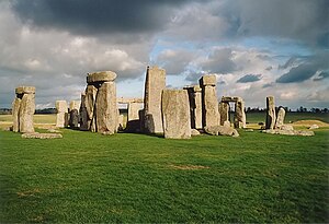
| 巨石阵、埃夫伯里和相关地点群 | 
|
英格兰威尔特郡 51°10′44″N 1°49′31″W / 51.1788°N 1.8252°W[34] |
4th–2nd millennia BC[34] | 373; 1986 (modified in 2008); i, ii, iii[34] |
The Neolithic sites of Avebury and Stonehenge are two of the largest and most famous megalithic monuments in the world. They relate to man's interaction with his environment. The purpose of the henges has been a source of speculation, with suggestions ranging from ceremonial to interpreting the cosmos. "Associated sites" includes Silbury Hill, Beckhampton Avenue, and West Kennet Avenue.[34] |
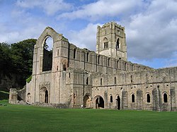
| 包括方廷斯隐修院废墟的斯塔德利王家公园 | 
|
英格兰北约克郡 54°06′58″N 1°34′23″W / 54.116°N 1.573°W[35] |
1132 (abbey), 19th century (park)[35] |
372; 1986; i, iv[35] |
Before the Dissolution of the Monasteries in the mid-16th century, Fountains Abbey was one of the largest and richest Cistercian abbeys in Britain and is one of only a few that survives from the 12th century. The later garden, which incorporates the abbey, survives to a large extent in its original design and influenced garden design in Europe.[35] |
| 倫敦塔 | 
|
英格兰大伦敦地区陶尔哈姆莱茨区 51°30′29″N 0°04′34″W / 51.5080°N 0.0761°W[36] |
11世纪[36] | 488; 1988; ii, iv[36] |
由征服者威廉于1066年在诺曼征服英格兰期间组织兴建。伦敦塔既是权力的象征也是广布于英格兰的诺曼军事建筑艺术(Norman military architecture)的一个例子。由亨利三世和爱德华一世在13世纪加建,使得城堡成为英格兰最具影响力的同类建筑之一。 [36] |
| 威斯敏斯特宫、西敏寺和圣玛格丽特教堂 | 
|
英格兰大伦敦地区威斯敏斯特 51°29′59″N 0°07′43″W / 51.4997°N 0.1286°W[37] |
10th, 11th, and 19th centuries[37] | 426; 1987 (modified in 2008); i, ii, iv[37] |
從11世紀起,這個地點一直是英格蘭乃至之後的聯合王國的行政中心。自征服者威廉起,所有有英格蘭和不列顛君主都在西敏寺接受加冕。哥德復興式建築風格的威斯敏斯特宫則是作為英國國會之用。St Margaret's Church is the palace's parish church, and although it pre-dates the palace and was built in the 11th century, it has been rebuilt since.[37][38][39] |
參考資料
- ^ United Kingdom of Great Britain and Northern Ireland: Properties inscribed on the World Heritage List, UNESCO, retrieved 2009-08-16
- ^ Aqueduct crowned world 'wonder', BBC Online, 2009-06-27, retrieved 2009-08-17
- ^ 4.0 4.1 4.2 4.3 Blenheim Palace, UNESCO, [2009-07-27]
- ^ 5.0 5.1 5.2 5.3 Canterbury Cathedral, St Augustine's Abbey, and St Martin's Church, UNESCO, [2009-08-15]
- ^ Church of St Martin, Images of England, [2009-08-16]
- ^ St Augustine's Abbey, Pastscape, [2009-08-16]
- ^ 8.0 8.1 8.2 8.3 Castles and Town Walls of King Edward in Gwynedd, UNESCO, [2009-08-12]
- ^ Liddiard (2005), p. 9.
- ^ 10.0 10.1 10.2 10.3 City of Bath, UNESCO, [2009-07-29]
- ^ 11.0 11.1 11.2 11.3 Cornwall and West Devon Mining Landscape, UNESCO, [2009-08-12]
- ^ 12.0 12.1 12.2 Derwent Valley Mills, UNESCO, [2009-07-27]
- ^ Derwent Valley Mills Partnership (2000), pp. 30–31, 96.
- ^ 14.0 14.1 14.2 Dorset and East Devon Coast, UNESCO, [2009-07-29]
- ^ 15.0 15.1 15.2 15.3 Durham Castle and Cathedral, UNESCO, [2009-07-27]
- ^ 16.0 16.1 16.2 16.3 Frontiers of the Roman Empire, UNESCO, [2009-07-28]
- ^ World Heritage List, UNESCO, [2009-07-27]
- ^ 18.0 18.1 18.2 18.3 Giant's Causeway and Causeway Coast, UNESCO, [2009-07-28]
- ^ 19.0 19.1 19.2 Gough and Inaccessible Island, UNESCO, [2009-08-12]
- ^ 20.0 20.1 20.2 20.3 Heart of Neolithic Orkney, UNESCO, [2009-07-28]
- ^ 21.0 21.1 21.2 Henderson Island, UNESCO, [2009-07-28]
- ^ 22.0 22.1 22.2 22.3 Historic Town of St George and Related Fortifications, Bermuda, UNESCO, [2009-08-02]
- ^ 23.0 23.1 23.2 23.3 Ironbridge Gorge, UNESCO, [2009-07-27]
- ^ 24.0 24.1 24.2 24.3 Liverpool – Maritime Mercantile City, UNESCO, [2009-07-29]
- ^ 25.0 25.1 25.2 25.3 Maritime Greenwich, UNESCO, [2009-07-29]
- ^ 26.0 26.1 26.2 26.3 New Lanark, UNESCO, [2009-07-28]
- ^ 27.0 27.1 27.2 27.3 Old and New Towns of Edinburgh, UNESCO, [2009-08-12]
- ^ 28.0 28.1 28.2 28.3 Pontcysyllte Aqueduct and Canal, UNESCO, [2009-08-12]
- ^ Listed Buildings: Pontcysyllte Aqueduct, Trevor, Wrexham County Borough Council, [2009-08-12]
- ^ 30.0 30.1 30.2 30.3 Royal Botanical Gardens, Kew, UNESCO, [2009-07-28]
- ^ 31.0 31.1 31.2 St Kilda, UNESCO, [2009-08-12]
- ^ Benvie (2000).
- ^ 33.0 33.1 33.2 33.3 Saltaire, UNESCO, [2009-07-28]
- ^ 34.0 34.1 34.2 34.3 Stonehenge, Avebury and Associated Sites, UNESCO, [2009-07-27]
- ^ 35.0 35.1 35.2 35.3 Studley Royal Park including the Ruins of Fountains Abbey, UNESCO, [2009-07-29]
- ^ 36.0 36.1 36.2 36.3 Tower of London, UNESCO, [2009-07-28]
- ^ 37.0 37.1 37.2 37.3 Westminster Palace, Westminster Abbey and Saint Margaret's Church, UNESCO, [2009-08-15]
- ^ History, Westminster Abbey, [2009-08-15]
- ^ Thornbury (1878), p. 567.

