亞拉:修订间差异
外观
删除的内容 添加的内容
无编辑摘要 |
小 linkfix |
||
| 第11行: | 第11行: | ||
|motto = |
|motto = |
||
<!-- images and maps -----------> |
<!-- images and maps -----------> |
||
|image_skyline = |
|image_skyline = Hatuey2.jpg |
||
|imagesize = |
|imagesize = |
||
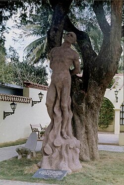
|image_caption = Monument of Taino chief Hatuey in Yara, depicting the moment he was burnt by Spanish soldiers. Bind to a [[Tamarind]] tree planted in 1907. |
|image_caption = Monument of Taino chief Hatuey in Yara, depicting the moment he was burnt by Spanish soldiers. Bind to a [[Tamarind]] tree planted in 1907. |
||
2018年2月3日 (六) 18:36的版本
此條目没有列出任何参考或来源。 (2013年3月13日) |
| Yara | |
|---|---|
| Municipality | |
 Monument of Taino chief Hatuey in Yara, depicting the moment he was burnt by Spanish soldiers. Bind to a Tamarind tree planted in 1907. | |
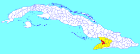
 Yara municipality (red) within Granma Province (yellow) and Cuba | |
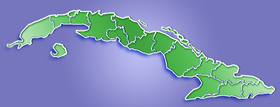
Location of Yara in Cuba | |
| 坐标:20°16′36″N 76°56′49″W / 20.27667°N 76.94694°W | |
| Country | |
| Province | Granma |
| Established | 1912 |
| 面积[1] | |
| • 总计 | 576 平方公里(222 平方英里) |
| 海拔 | 30 公尺(100 英尺) |
| 人口(2004)[2] | |
| • 總計 | 59,415人 |
| • 密度 | 103.2人/平方公里(267人/平方英里) |
| 时区 | EST(UTC-5) |
| 電話區號 | +53-23 |
亞拉是古巴的城鎮,属格拉瑪省,始建於1912年,面積576平方公里,海拔高度30米,2004年人口59,415,人口密度為每平方公里103.2人。
| 这是一篇古巴地理小作品。您可以通过编辑或修订扩充其内容。 |

